Route des Grandes Alpes: From Lake Geneva to the Mediterranean
Activity stats
The Route des Grandes Alpes is one of cycling’s ultimate bucket-list rides: 700+ km through the heart of the French Alps, from the shores of Lake Geneva to the Mediterranean in Nice. Sixteen cols, six days, and some of the most famous climbs in the sport. We rode it in July 2025.
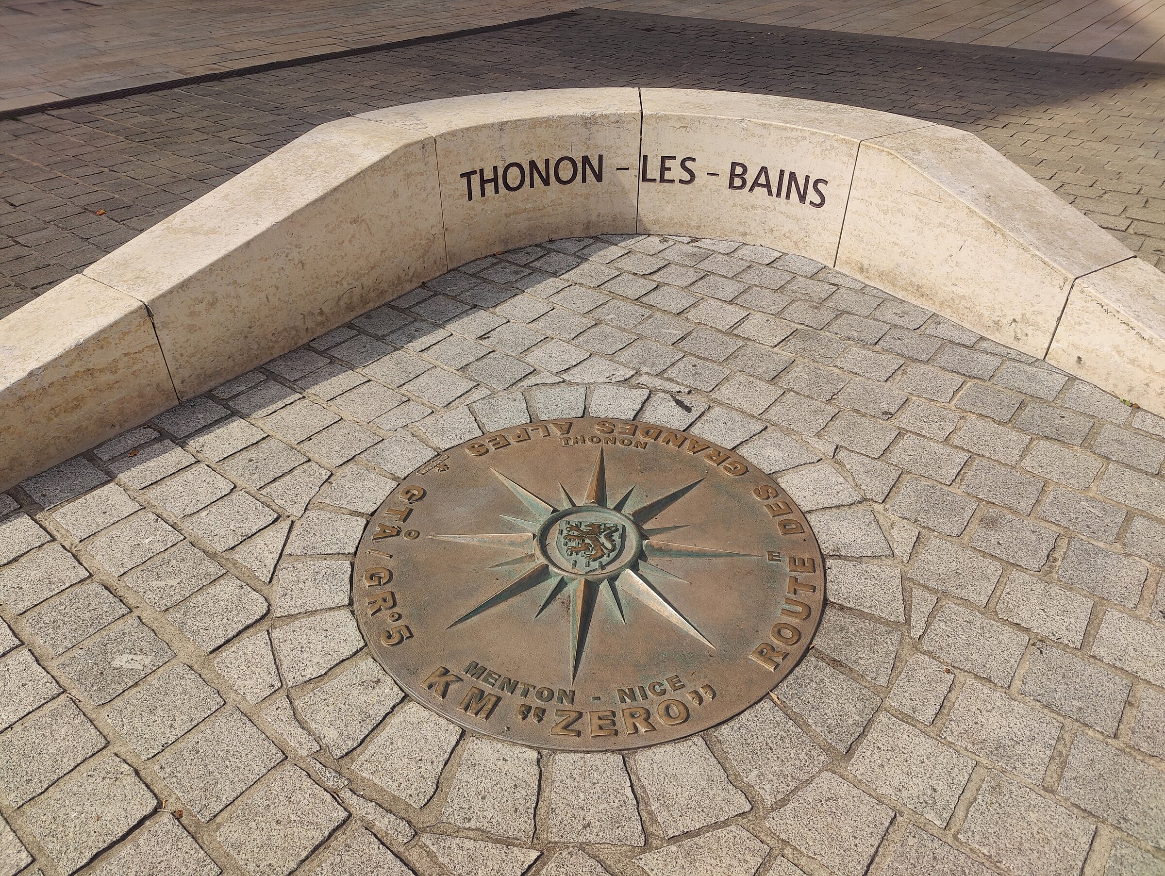
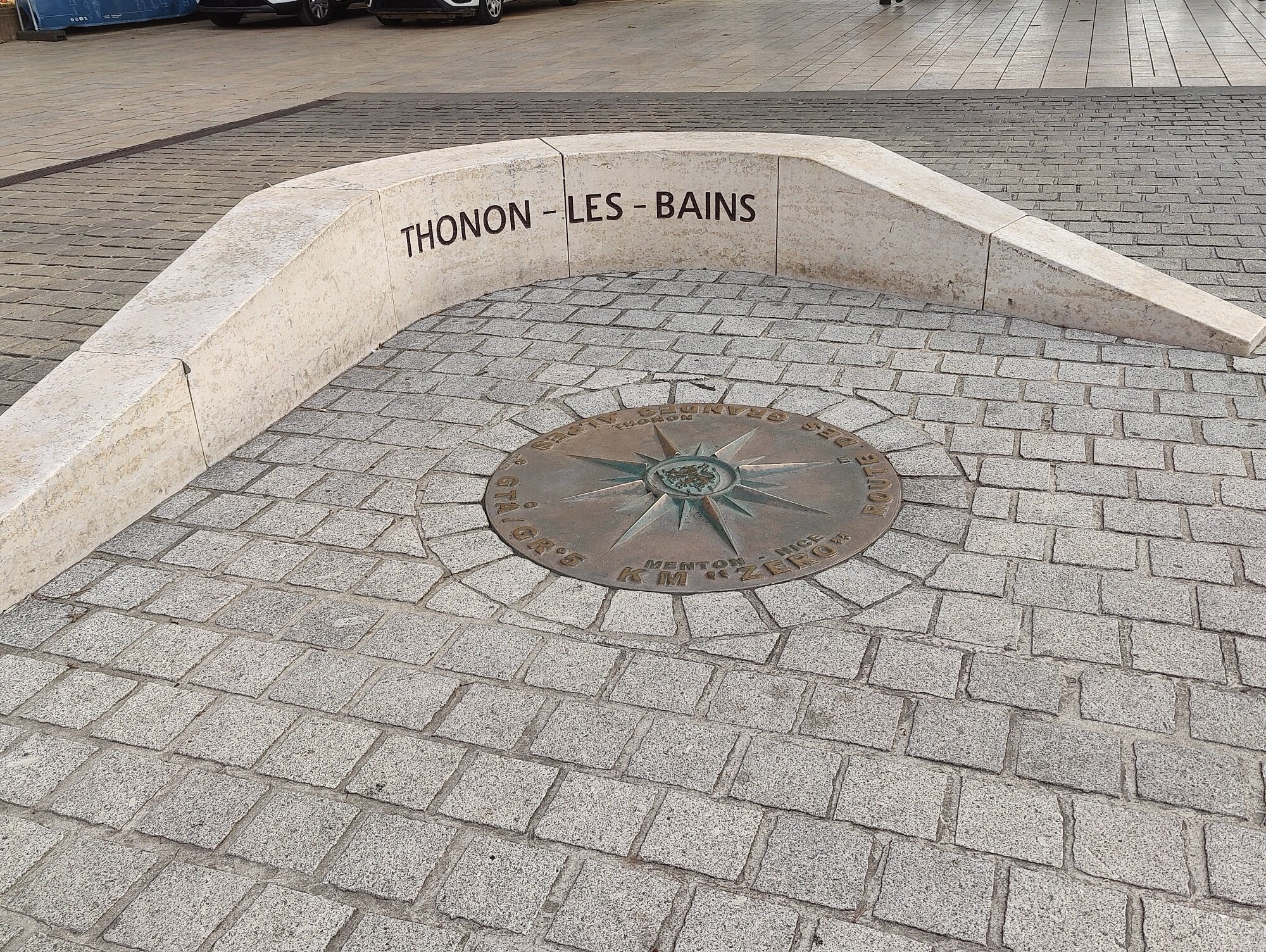
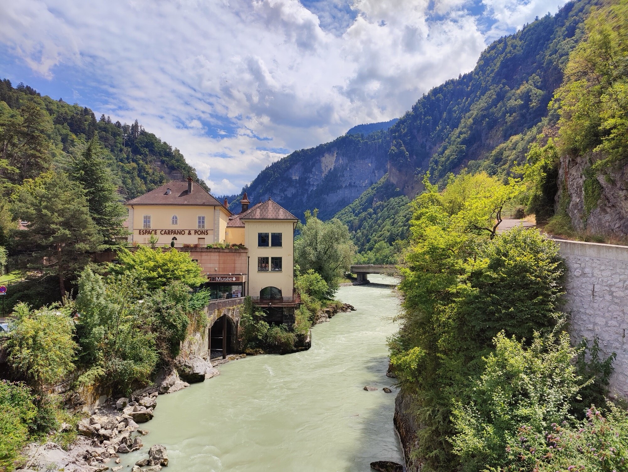
We arrived in Thonon-les-Bains the evening before, having ridden over from La Clusaz where we’d met up. A quick tour around town, then straight to find the famous start marker painted on the ground — we wanted to see it before the ride, not just race past it in the morning. After that, an early dinner and a good night of sleep. The next six days would demand it.
Overview
| Day | From → To | km | D+ | D- | Cols |
|---|---|---|---|---|---|
| 1 | Thonon-les-Bains → Le Grand-Bornand | 120.7 | 3,017 | 2,508 | 3 |
| 2 | Le Grand-Bornand → Bourg-Saint-Maurice | 97.8 | 2,746 | 2,841 | 3 |
| 3 | Bourg-Saint-Maurice → Saint-Michel-de-Maurienne | 124.5 | 2,341 | 2,435 | 1 |
| 4 | Saint-Michel-de-Maurienne → Guillestre | 123.4 | 3,346 | 3,087 | 3 |
| 5 | Guillestre → Saint-Étienne-de-Tinée | 94.6 | 2,886 | 2,704 | 2 |
| 6 | Saint-Étienne-de-Tinée → Nice | 164.8 | 3,084 | 4,229 | 4 |
| Total | 725.8 | 17,420 | 17,804 | 16 |
Day 1
Thonon-les-Bains → Le Grand-Bornand
120.7 km | 3,017 m D+ | 2,508 m D- | 3 cols
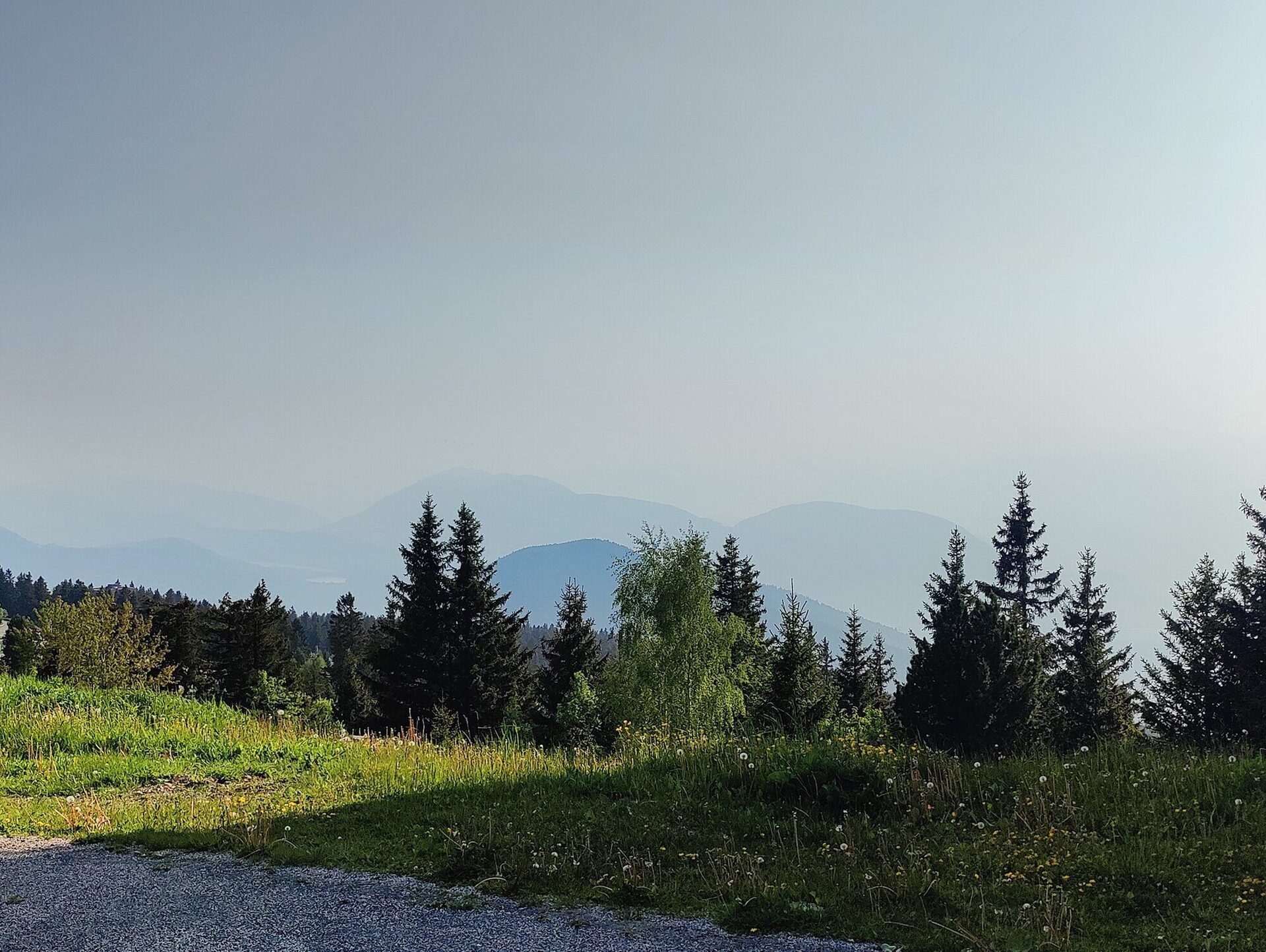
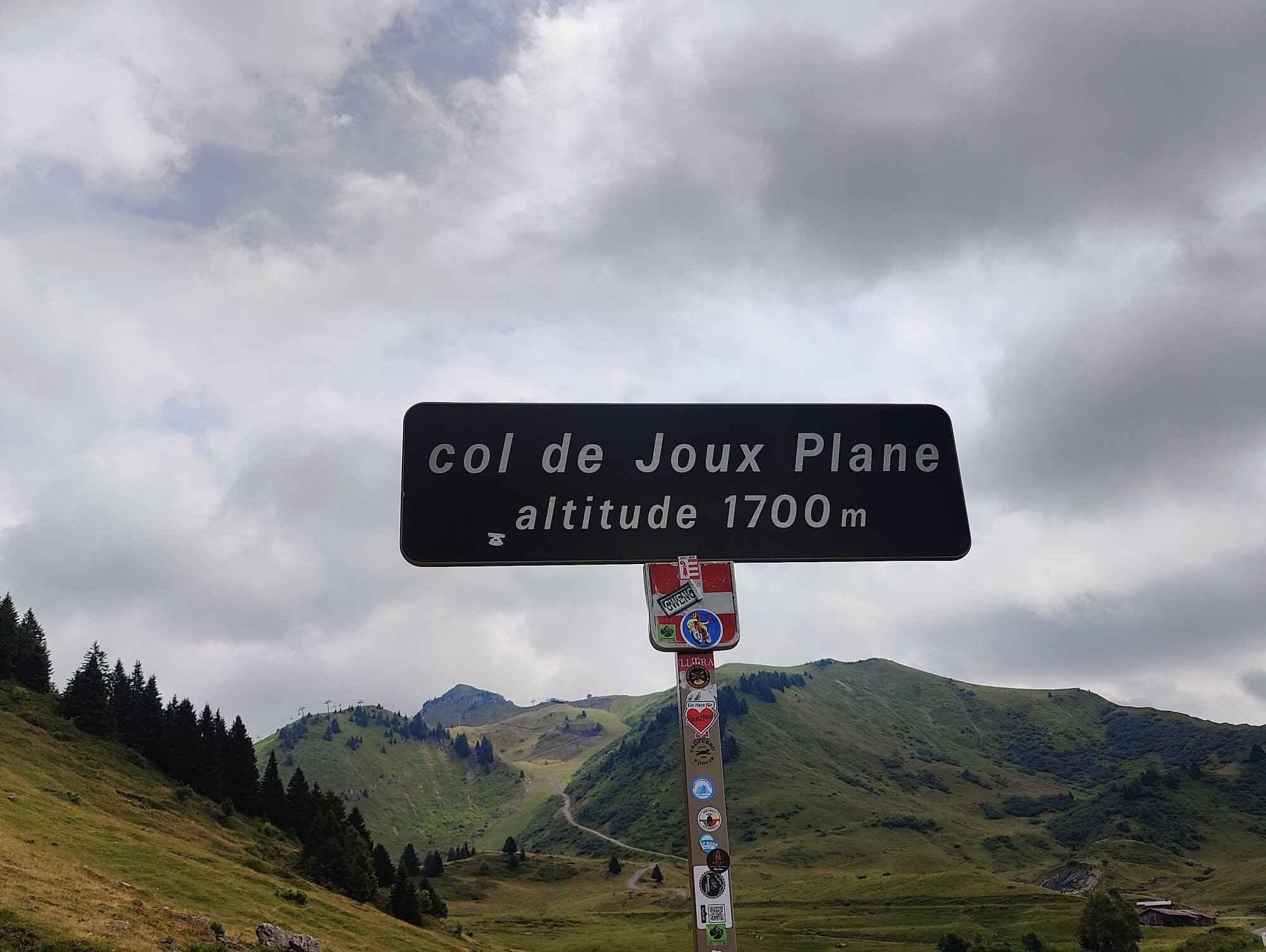
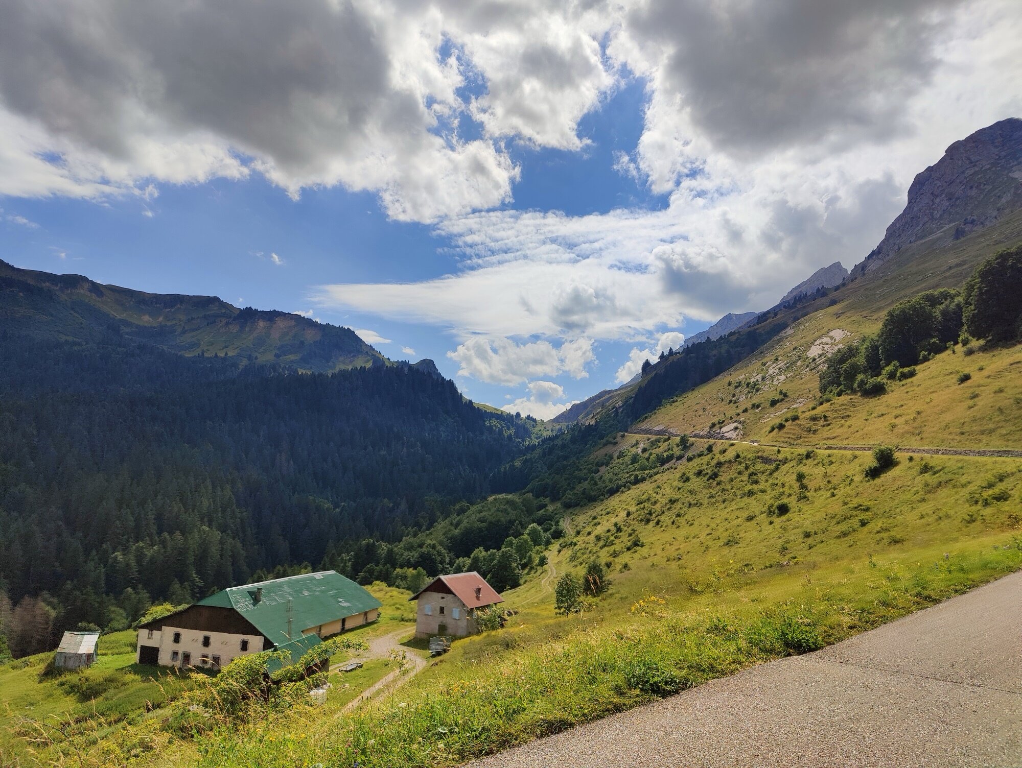
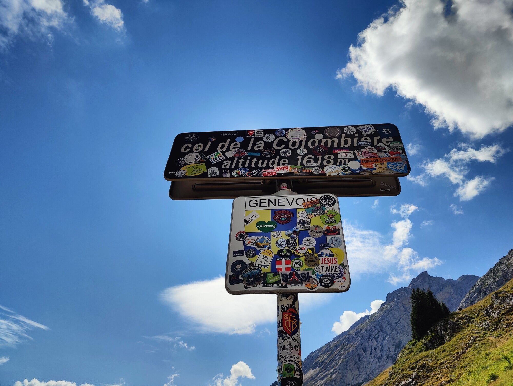
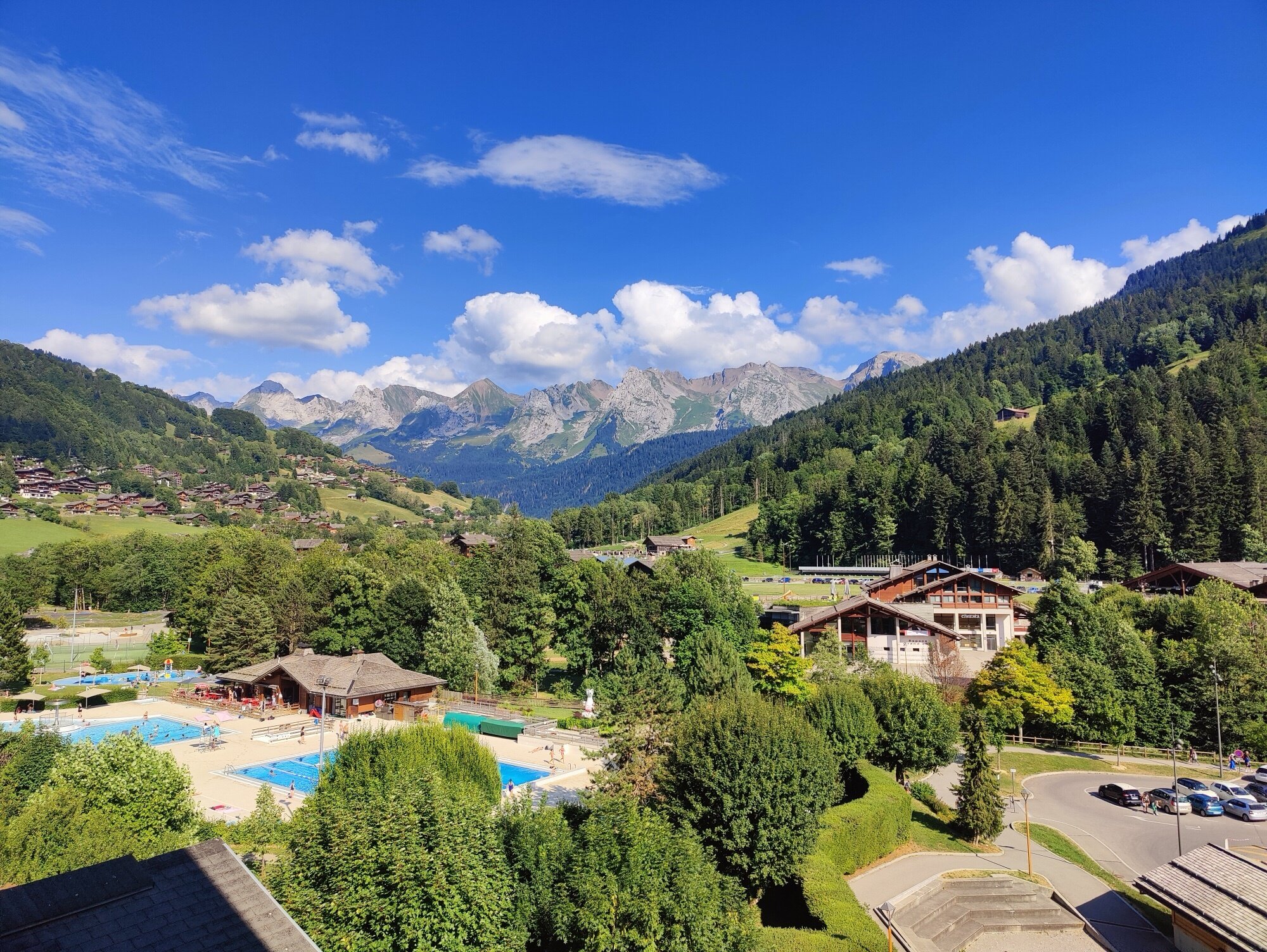
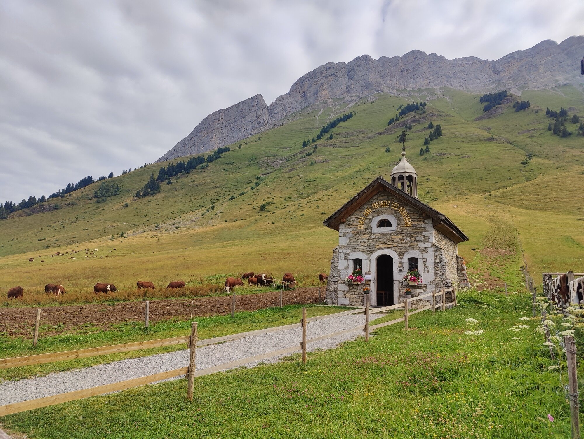
We took the start photo at the same spot we’d scouted the night before and rolled out around 8 AM. The original plan was to open with the Col du Feu, but when we reached the intersection a sign said it was closed. We had an alternative route planned via the Col des Gets, but instead we decided to go for the Col de Joux Plane — the harder option, but we thought it was a better idea. The first kilometers hit hard with steep gradients, but it was a really nice climb, and the descent on the other side was even better. We dropped into Samoëns and had lunch at a nice little café in town. Then another small col just to cross over to the other side of the valley, and then we were up for the real highlight of the day: the Col de la Colombière. Maybe one of the most difficult cols of the entire trip — a lot of climbing, very long. But we knew that once we reached the top, it was just a matter of going down and arriving in Le Grand-Bornand, where we stayed for the night.
Our rerouted first big test. The climb via the Col de Ranfolly features sustained double-digit gradients in the final kilometres that never let up. Tough in the first kilometers, but the descent made it worth every pedal stroke.
A small connecting pass between Samoëns and the Arve valley. Nothing dramatic, but a welcome breather between the two main climbs of the day.
The real highlight of the opening day — and possibly one of the hardest cols of the whole trip. The north side from Le Reposoir is steady and scenic, winding through alpine pastures. After the summit, it was just a matter of rolling down to Le Grand-Bornand for the night.
Day 2
Le Grand-Bornand → Bourg-Saint-Maurice
97.8 km | 2,746 m D+ | 2,841 m D- | 3 cols
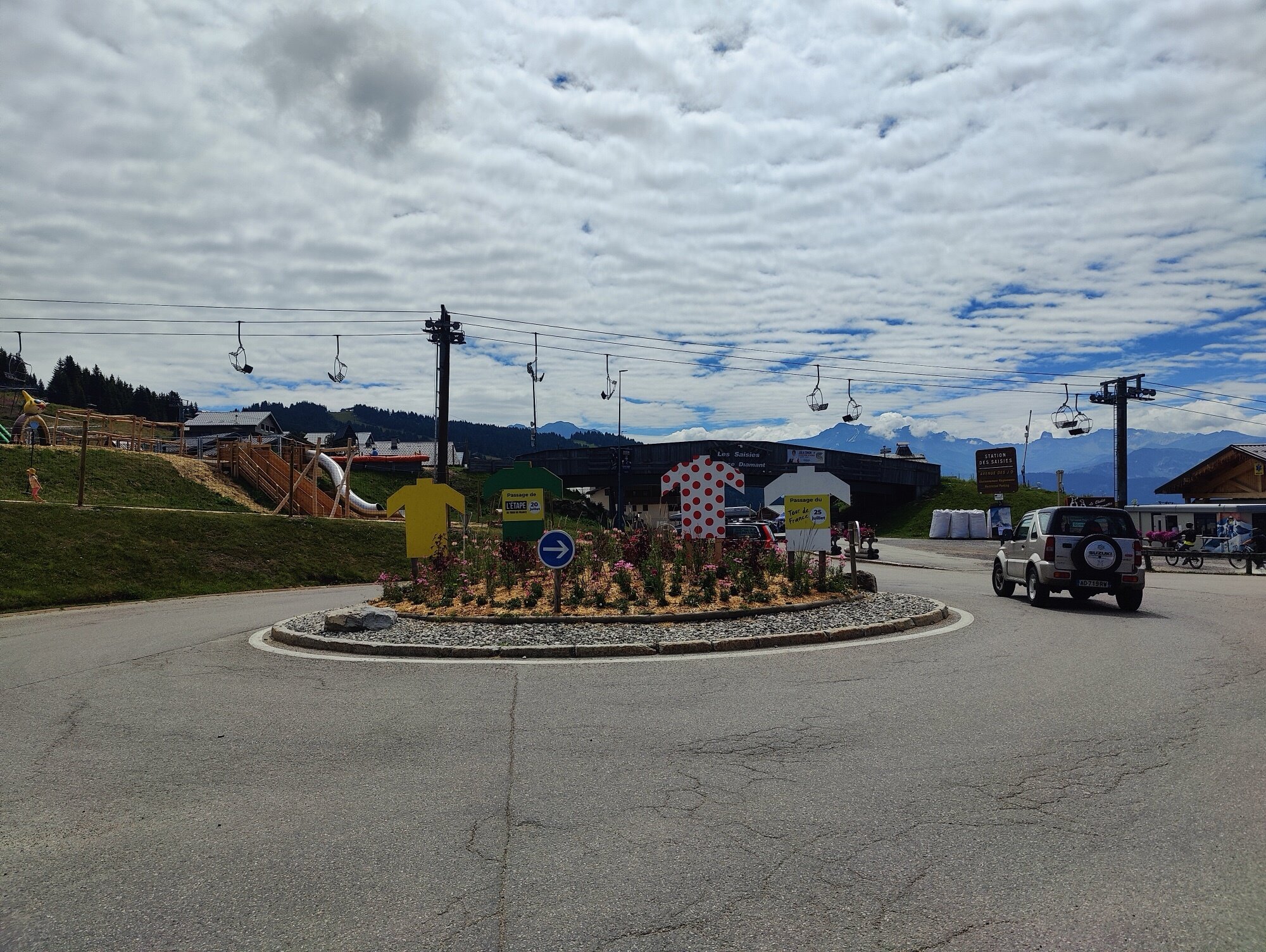
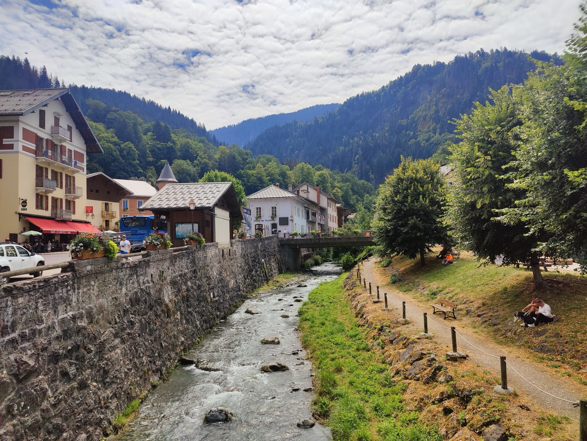
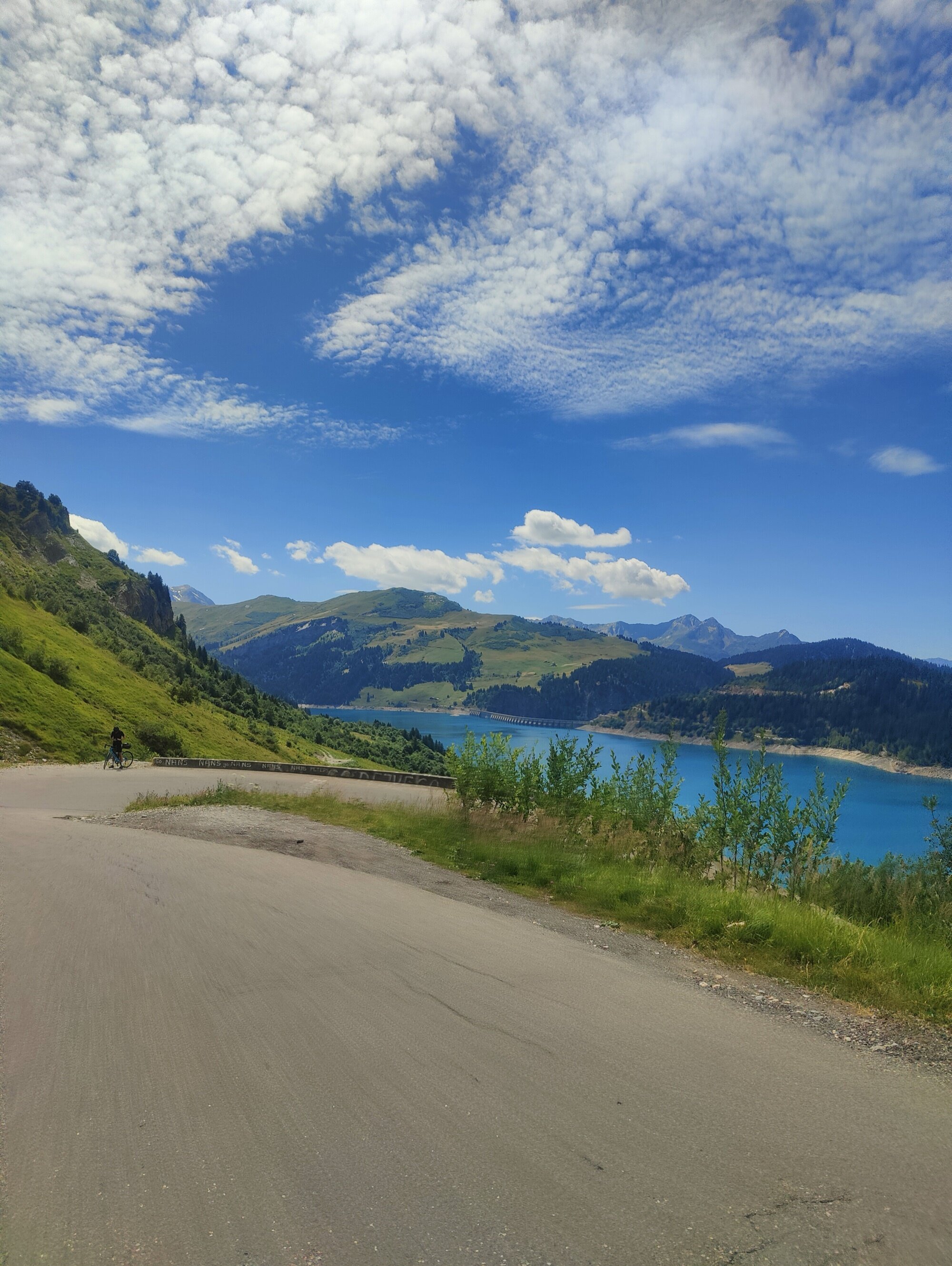
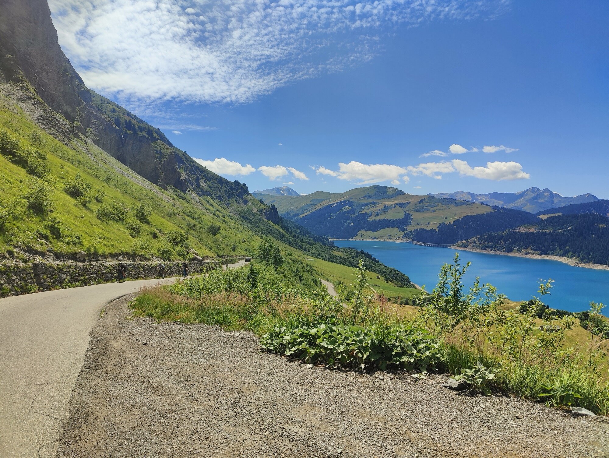
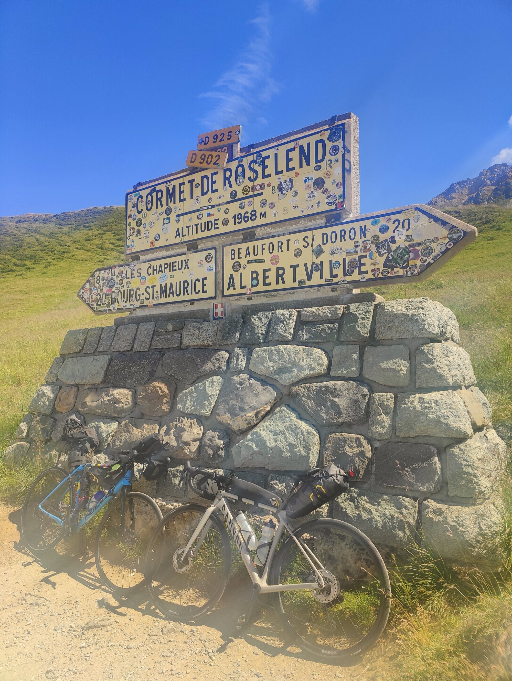
The weather was a bit cloudy in the morning, but it got better as the day went on. We did the Col des Aravis, went down, then the Col des Saisies. We arrived in Beaufort and had a quick lunch before starting the last climb to the Cormet de Roselend. This is where we met another cyclist, also named Jeremy — we did a good chunk of the climb with him all the way to the top. Just like the day before, the descent was a highlight, all the way down to Bourg-Saint-Maurice where we stayed for the night. A beer that evening to celebrate the first two days.
A gentle opener with a big reward — Mont Blanc fills the horizon at the summit. Short, scenic, and a nice way to ease into the day.
The longest climb of the day, but the gradients are forgiving. A rolling road through the Beaufortain countryside rather than a relentless mountain wall.
One of the most beautiful climbs in the Alps. The final approach to the turquoise reservoir is unforgettable — and this is where we picked up a riding companion for the afternoon. The descent into the Tarentaise valley afterwards is fast and sweeping.
Day 3
Bourg-Saint-Maurice → Saint-Michel-de-Maurienne
124.5 km | 2,341 m D+ | 2,435 m D- | 1 col
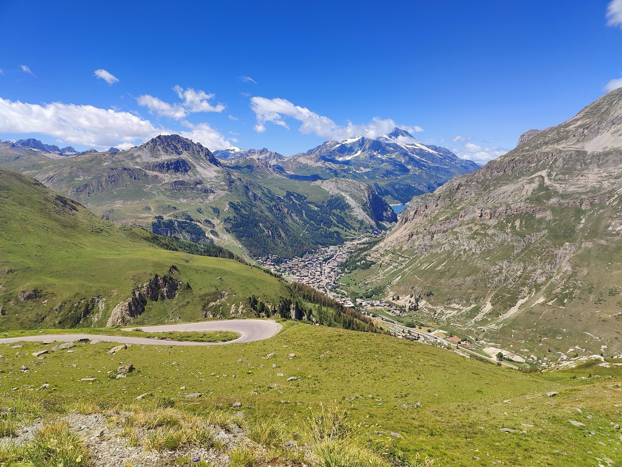
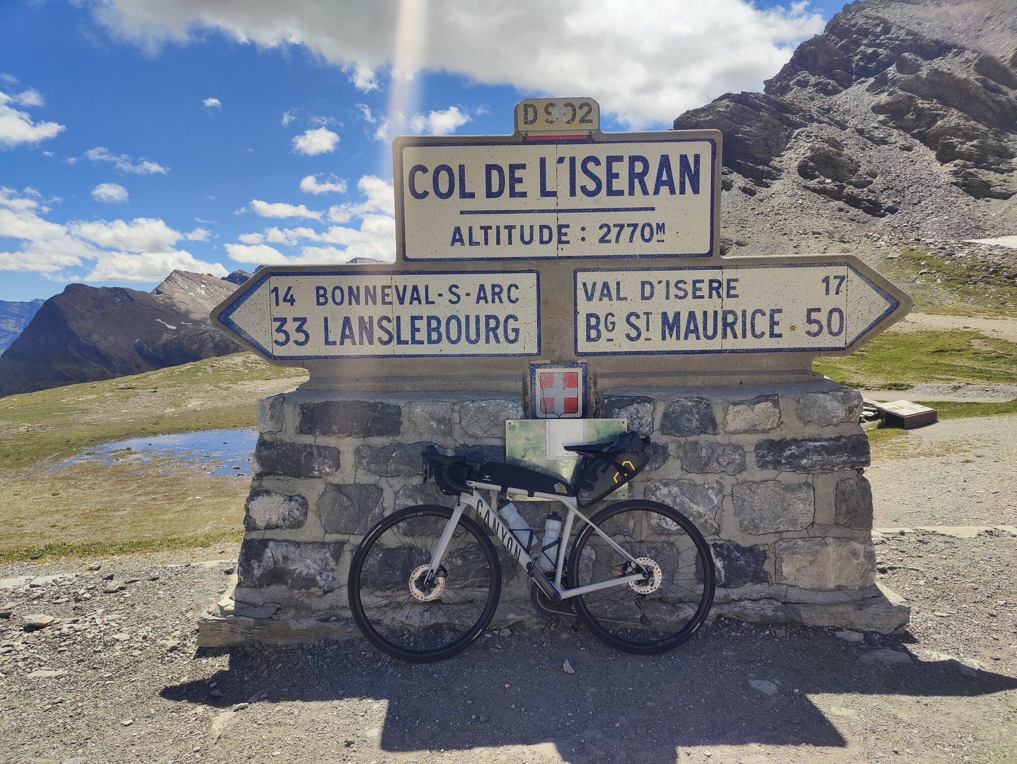
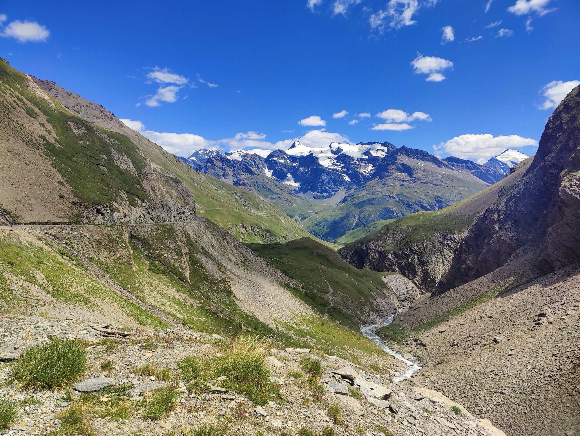
Just one major climb this day, but a big one — one of the highest points of the trip. We did a good chunk of it with the Jeremy we’d met the day before. A very long climb, passing through the famous ski stations of Val d’Isère and Tignes. We even got to see professional cyclists training there — team cars parked at the turns, everything looking just like the Tour de France. It wasn’t, of course — probably a team on a training camp.
After the Col de l’Iseran, a very long descent to Bonneval-sur-Arc, where we stopped for a quick drink. We knew the rest would be a long but gently descending finish — still quite a lot of kilometres, and we thought it would be easy. But with a headwind, it turned into a grind that took much longer than expected. We arrived in Saint-Michel-de-Maurienne in the evening, just before dinner.
The highest paved pass in the Alps at 2,770 m. After Val d’Isère the road climbs above the treeline into a stark, high-altitude world. We shared the road with pro cyclists training in the area, their team cars parked at the turns — it all looked just like the Tour de France, but it wasn’t.
Day 4
Saint-Michel-de-Maurienne → Guillestre
123.4 km | 3,346 m D+ | 3,087 m D- | 3 cols
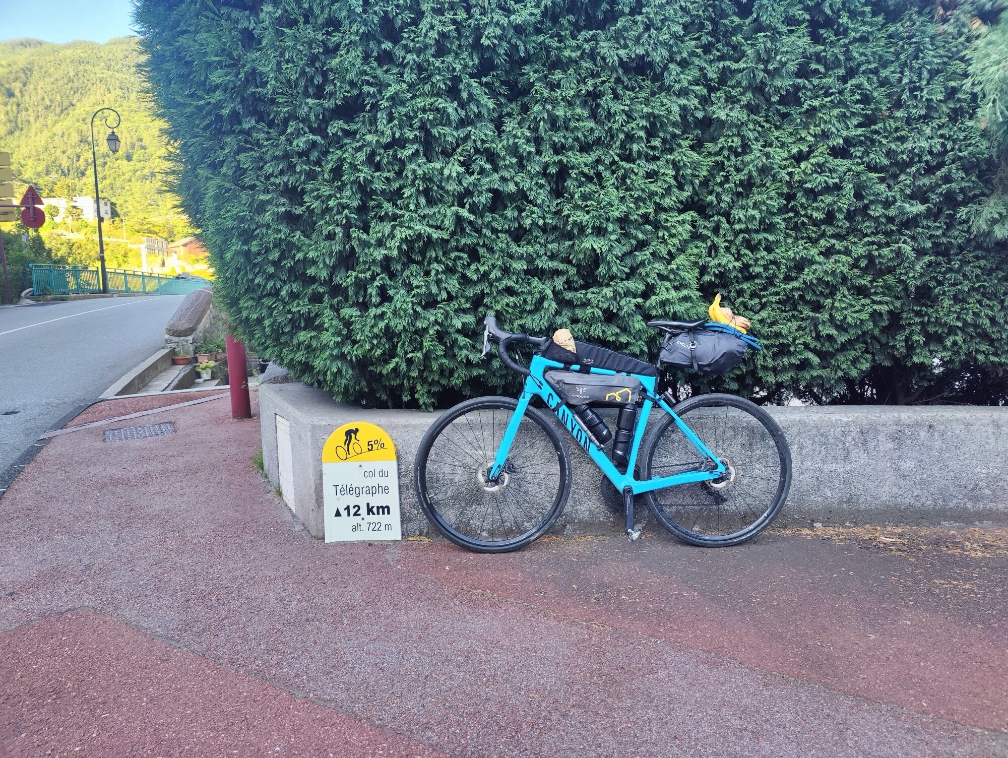
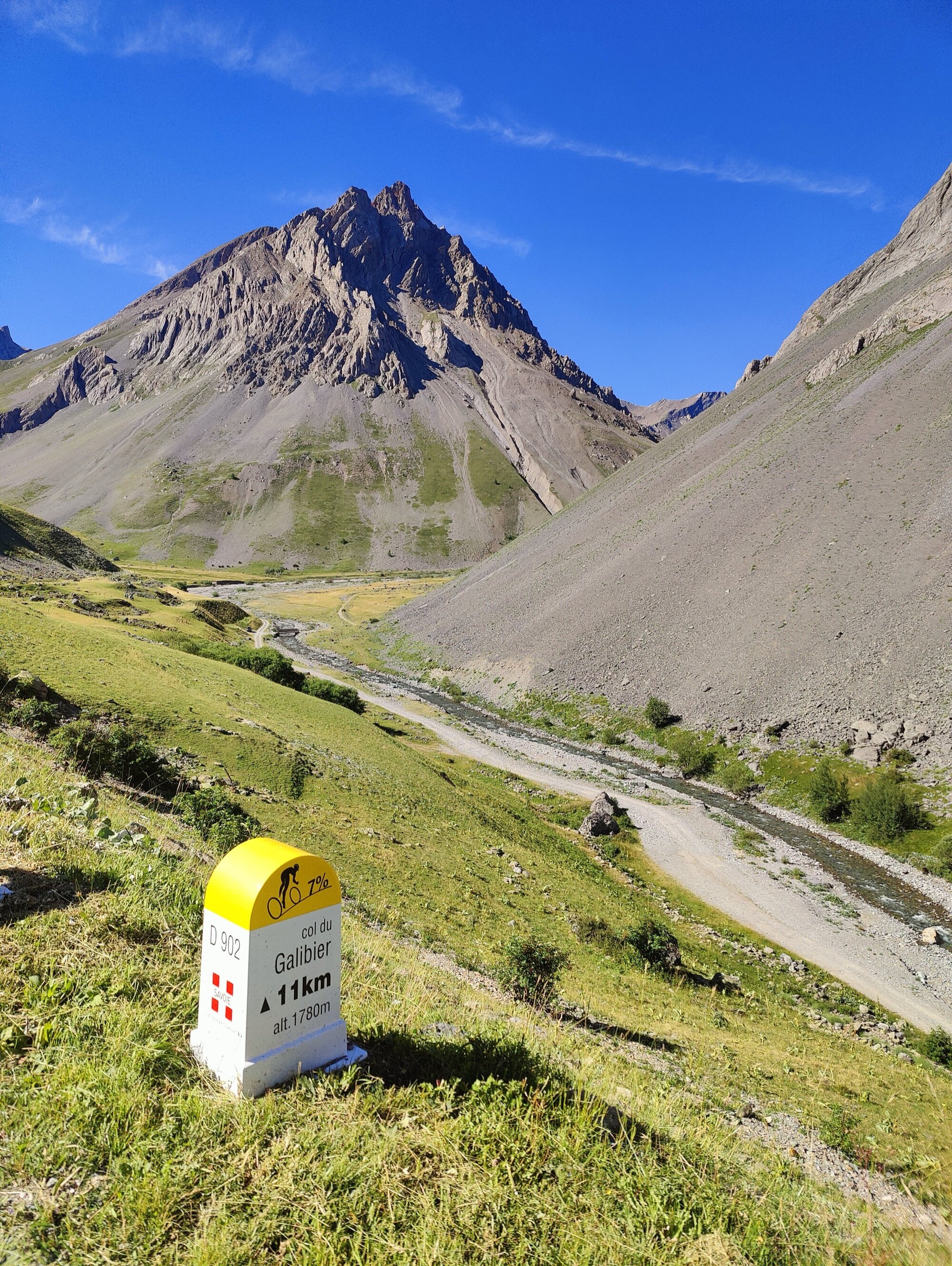
Day four — this was the big day. The famous Col du Galibier and the Col d’Izoard right after. We knew it was probably going to be the hardest day, the most elevation — two major climbs, three if you count the Col du Télégraphe at the start. No time to warm up: we started a few metres out of Saint-Michel and were climbing immediately.
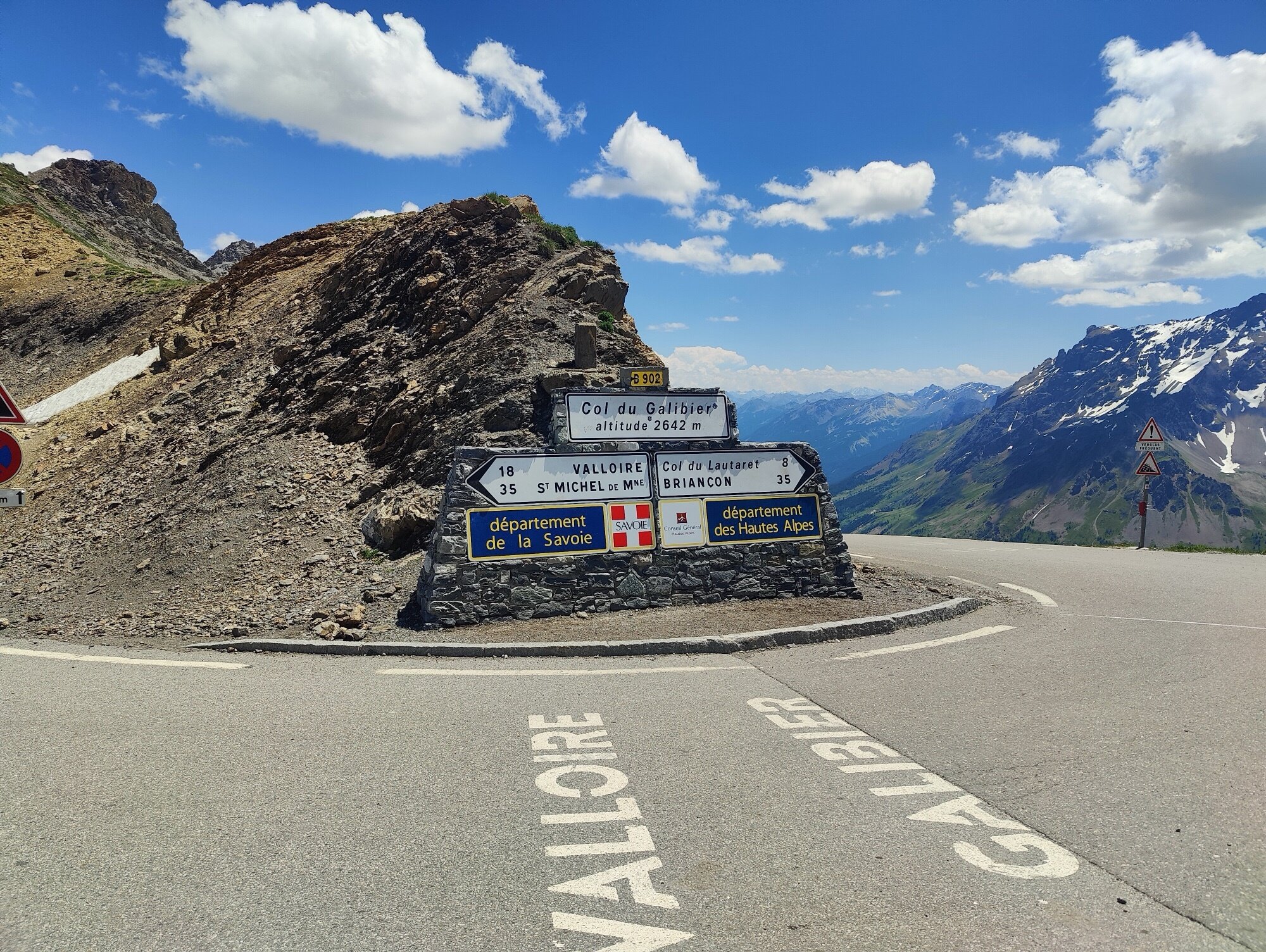
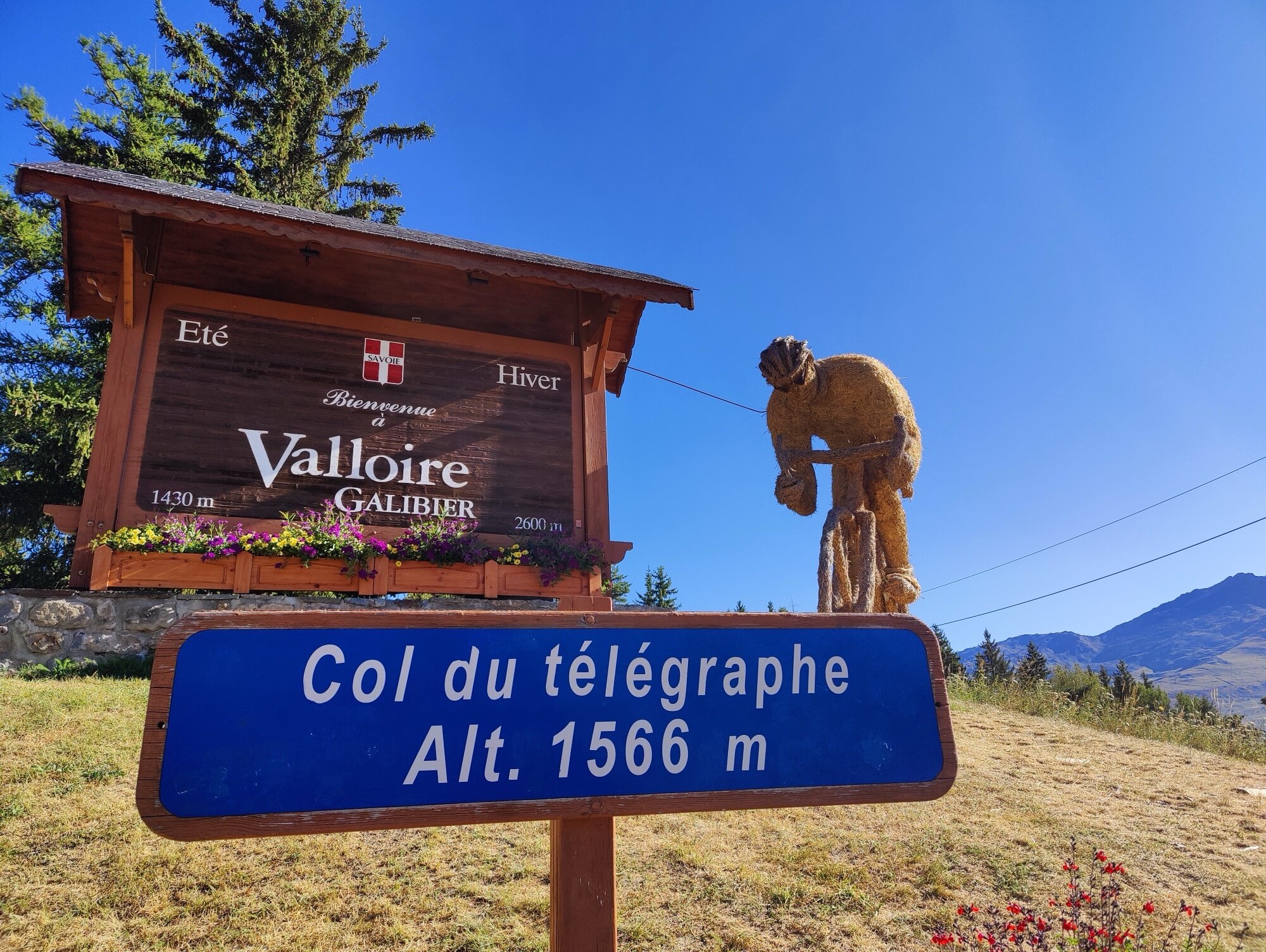
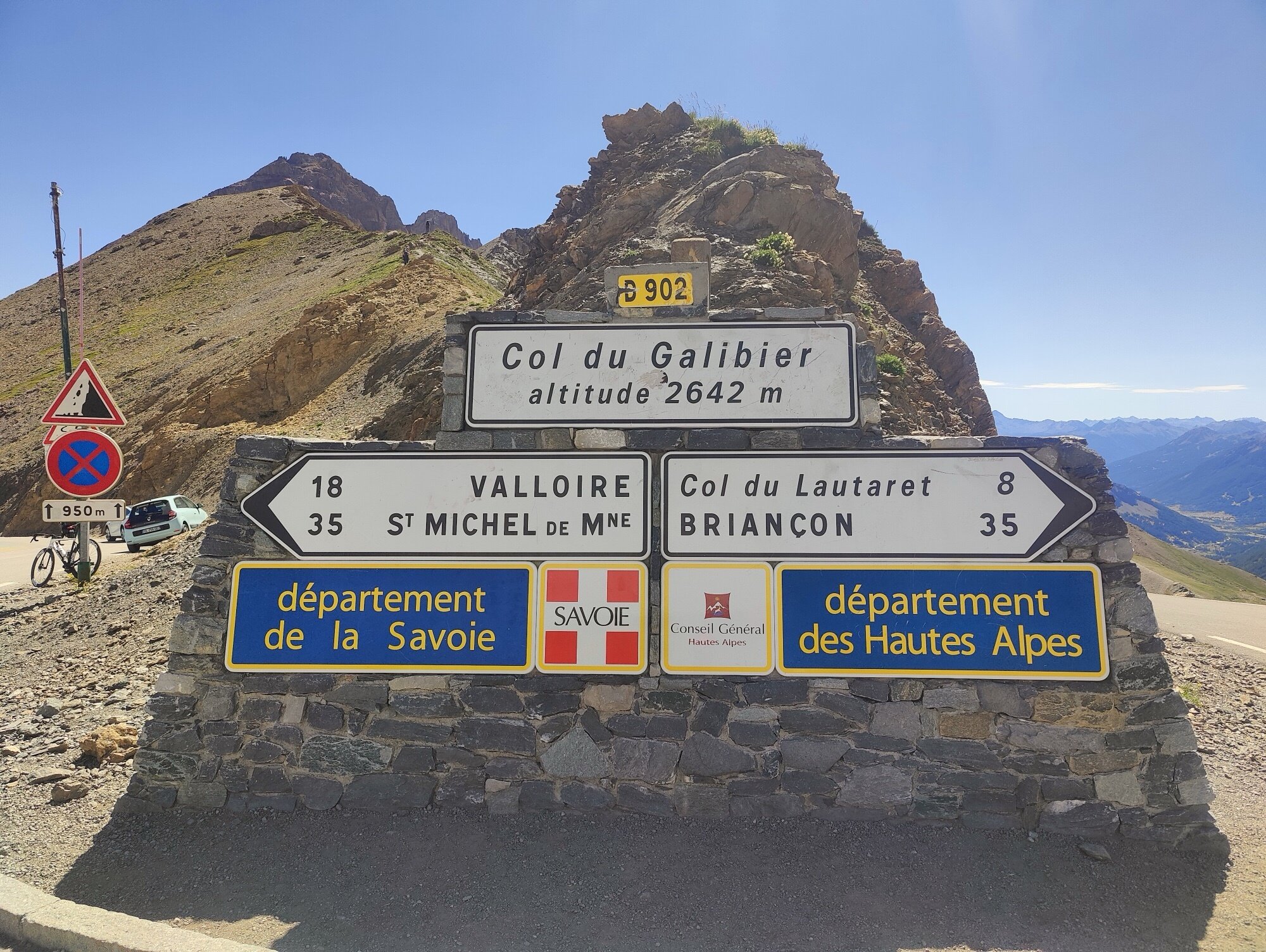
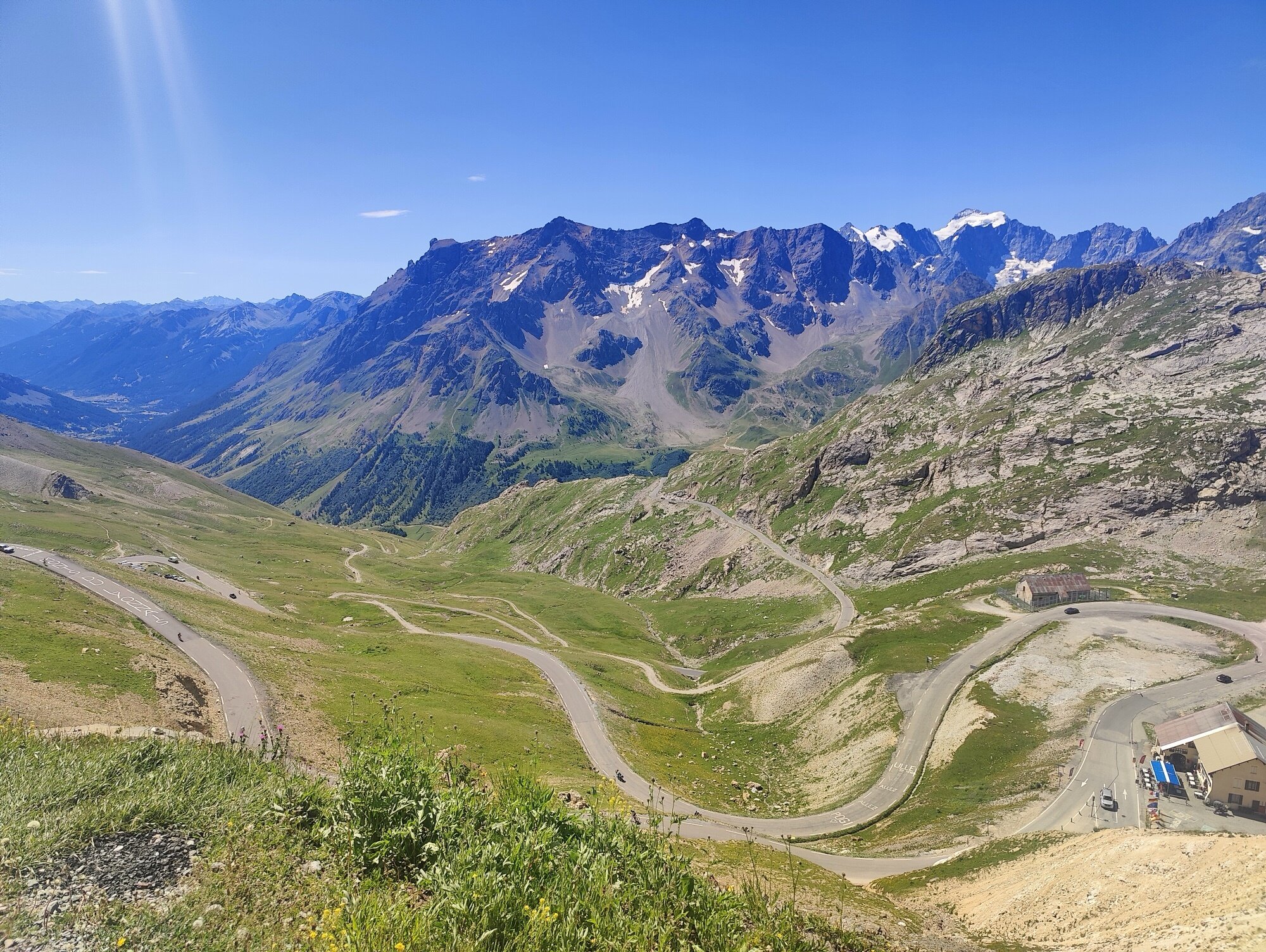
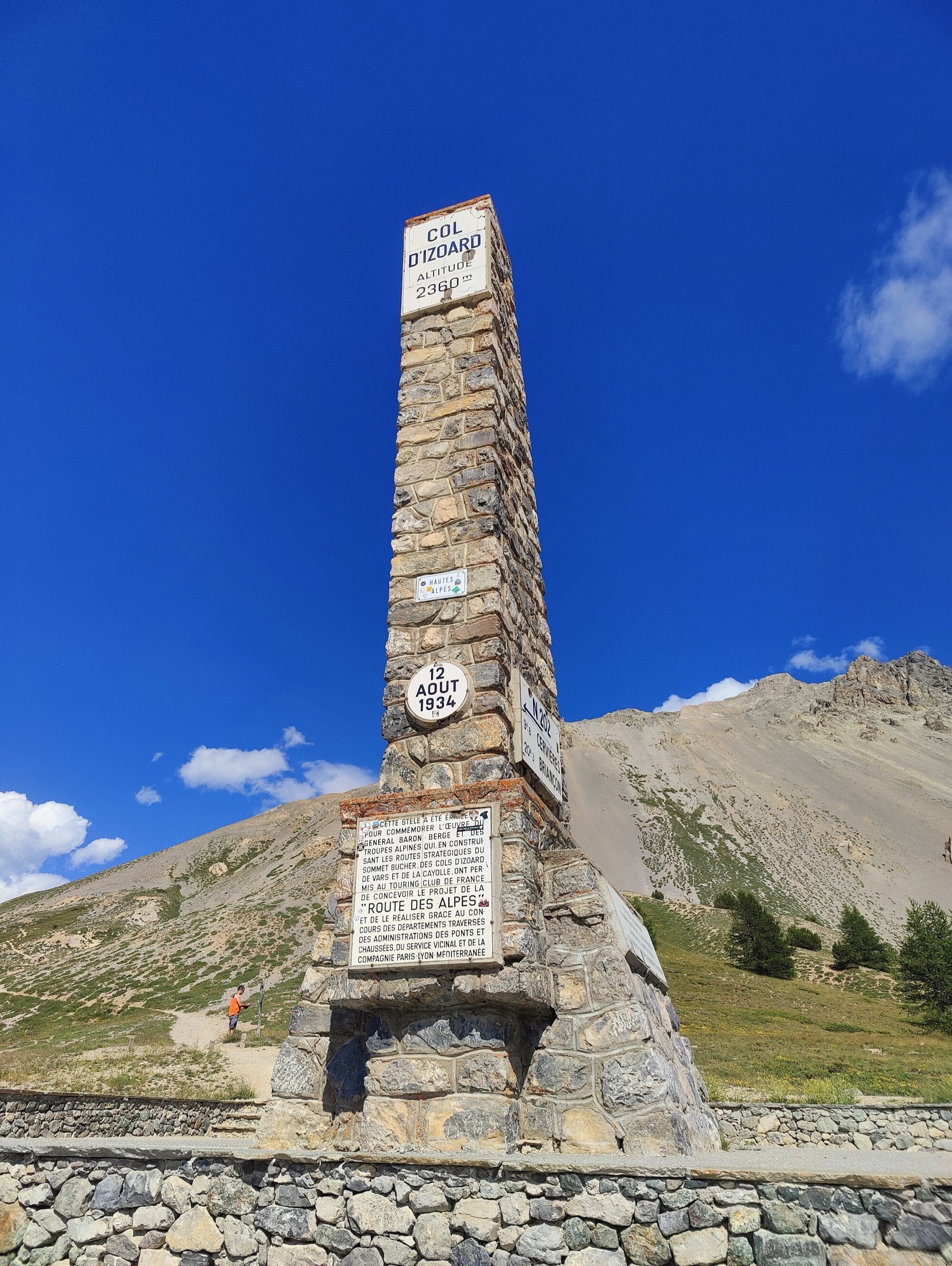
The Col du Télégraphe — everything went well. Then a short descent to Valloire, and from there the famous Col du Galibier. We reached the summit a little before noon and decided to continue down into the valley before Briançon for crêpes. After lunch we carried on to Briançon, where the climb to the Col d’Izoard begins.
That day was really, really hot. We were starting to struggle, so we took a break mid-climb just because it was so warm. But in the afternoon, around 4:30 PM, we managed to reach the top. Then down, and a stretch of flat to reach Guillestre, where we stayed for the night. Dinner at a restaurant, then rest — the next day would need it.
No time to warm up. The Col du Télégraphe starts almost immediately out of Saint-Michel-de-Maurienne — a steady 12 km climb, and everything went well. But it comes right before the Galibier, so pacing matters.
The iconic col. Above 2,000 m the landscape opens up completely — barren rock, thin air, and the famous monument to Henri Desgrange at the summit. We arrived a little before noon, then descended a bit further into the valley before Briançon for crêpes.
That day was really, really hot — we were starting to struggle and had to take a break during the climb just because it was so warm. We managed to reach the top around 4:30 PM. The Casse Déserte on the south side is one of cycling’s most otherworldly landscapes — eroded pinnacles of rock standing in orange scree.
Day 5
Guillestre → Saint-Étienne-de-Tinée
94.6 km | 2,886 m D+ | 2,704 m D- | 2 cols
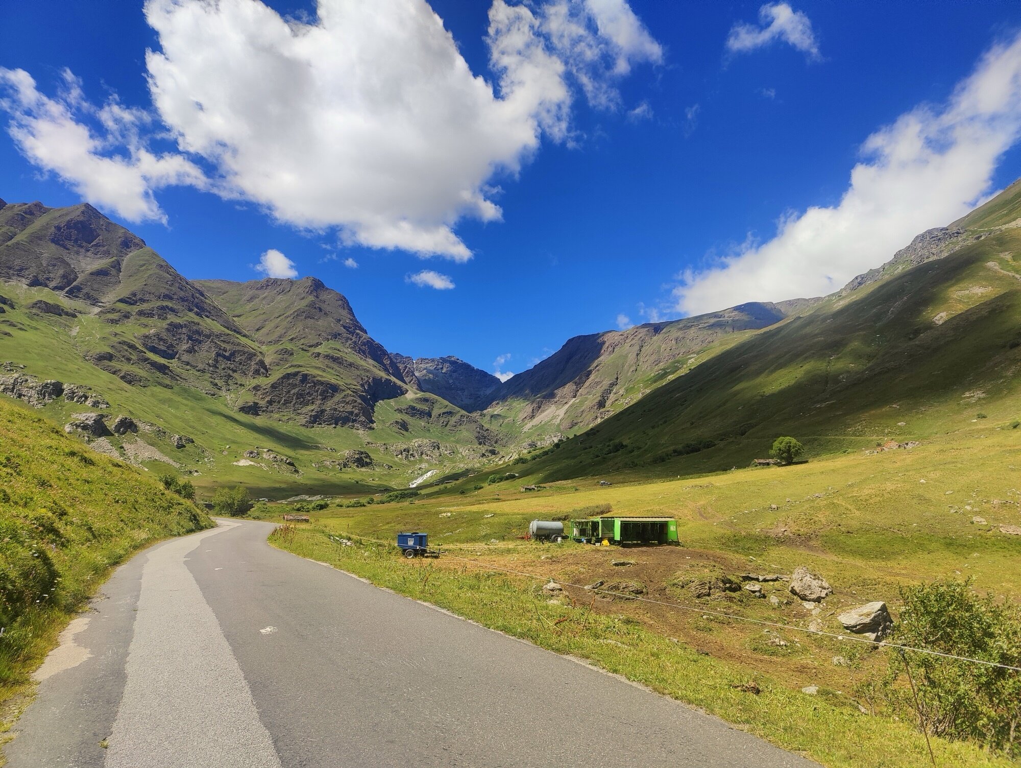
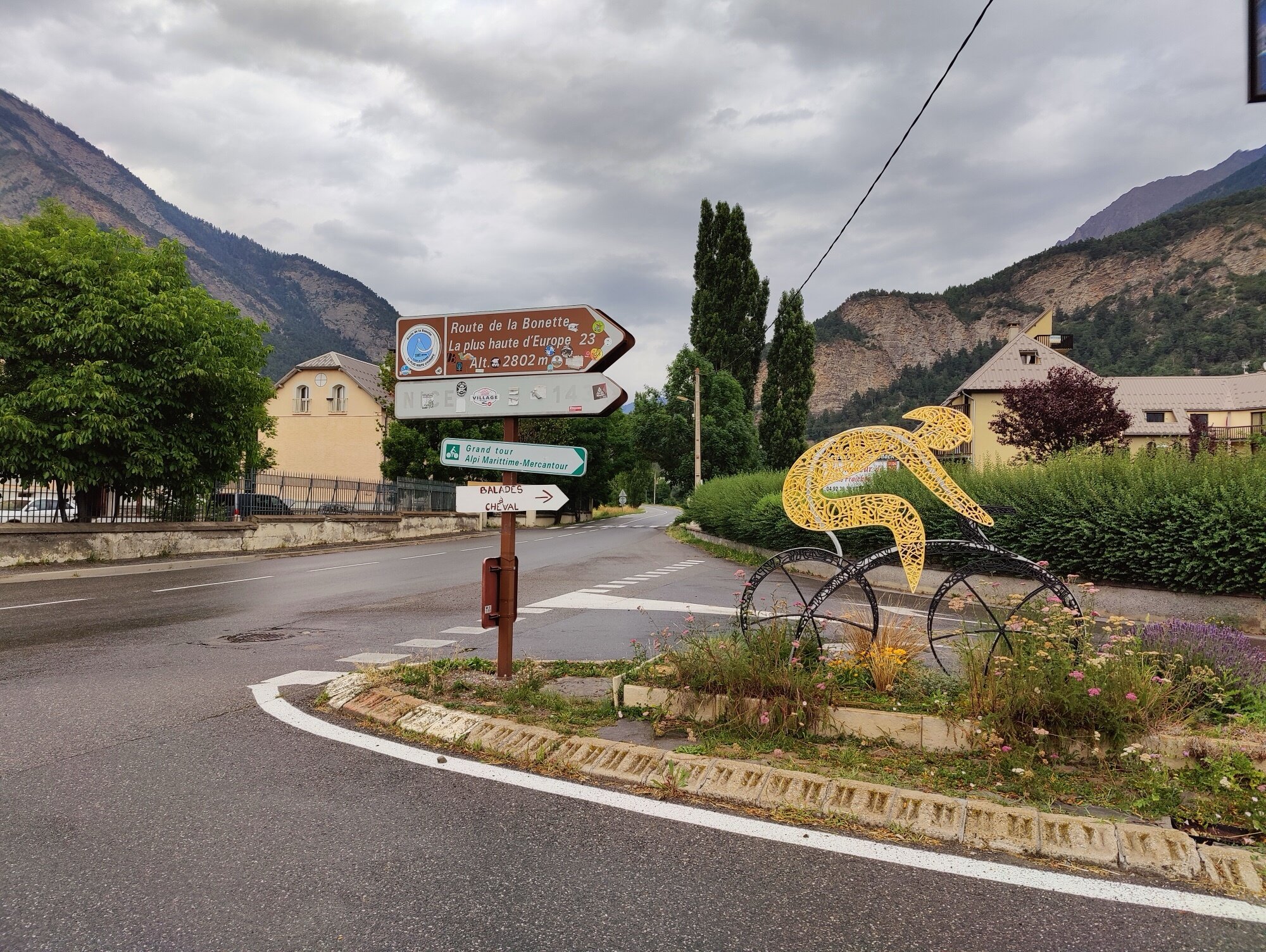
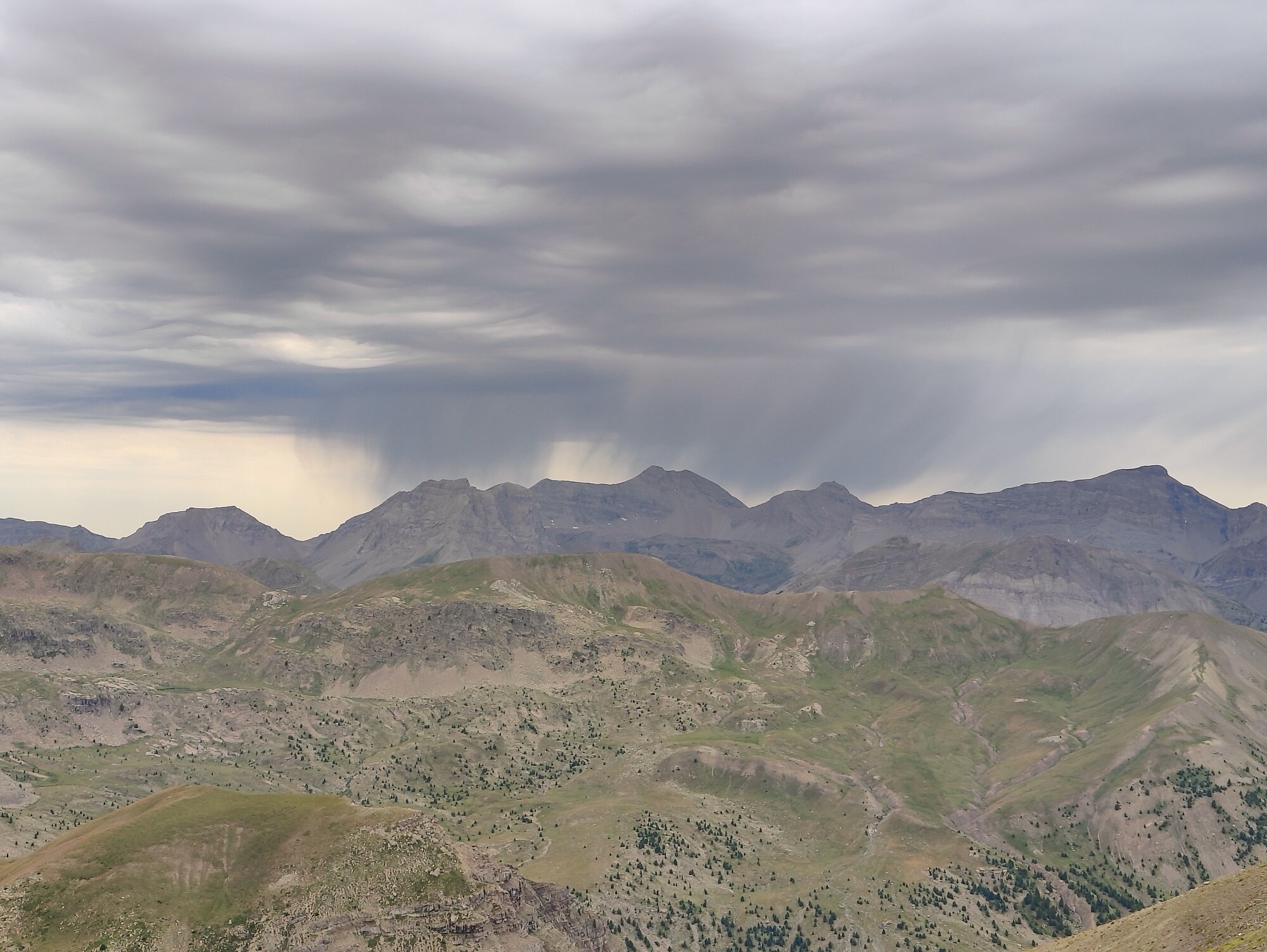
The next day started under heavy cloud, and the weather didn’t look promising. We began the climb toward the Col de Vars, but the GPS trace we’d found on the official website led us into dead ends. We climbed more than we should have and lost time in the morning. We ended up doubling back almost to where we’d started and took the official road to the Col de Vars, where the rain caught us. After that, it rained almost the whole day.
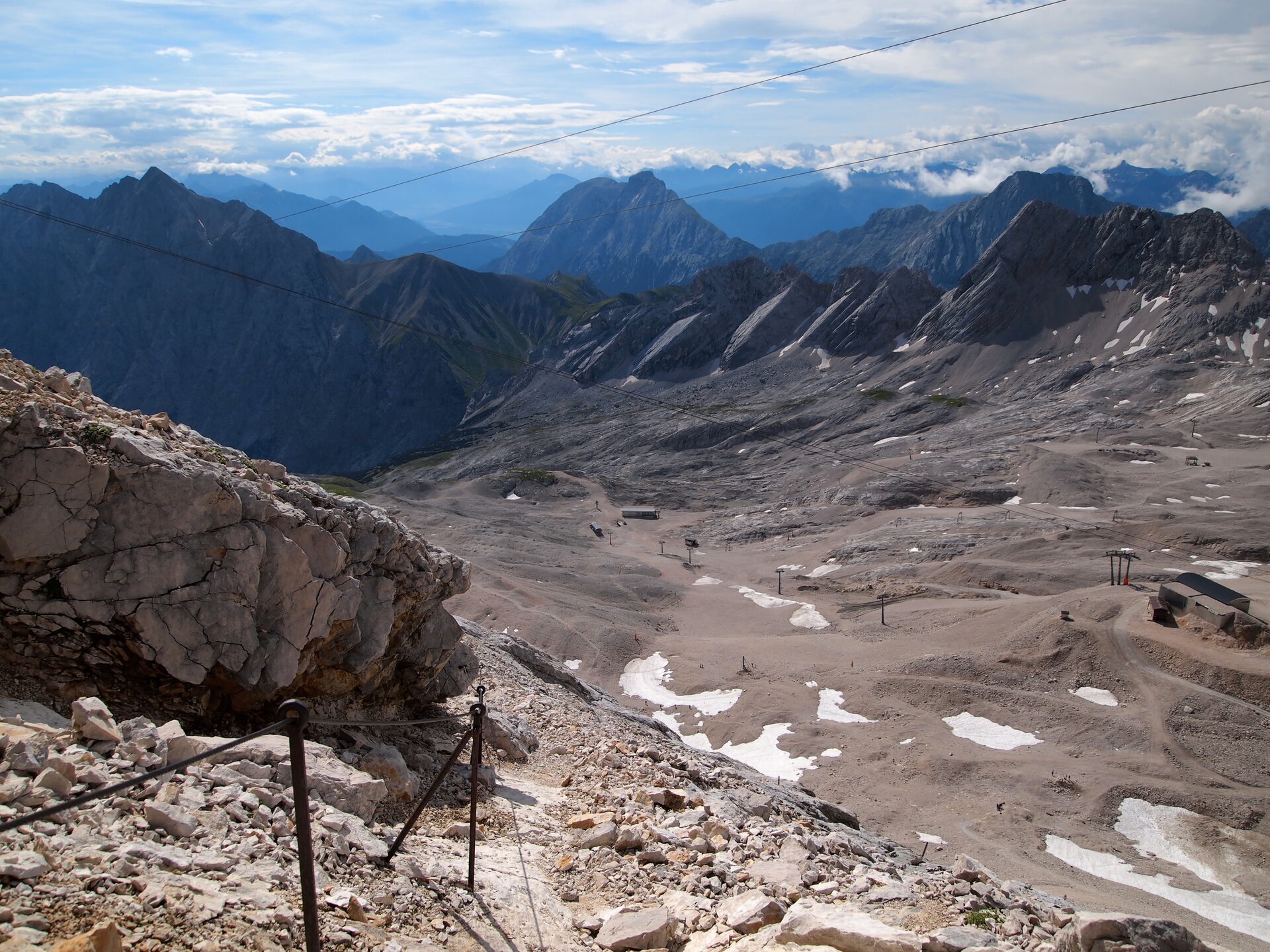
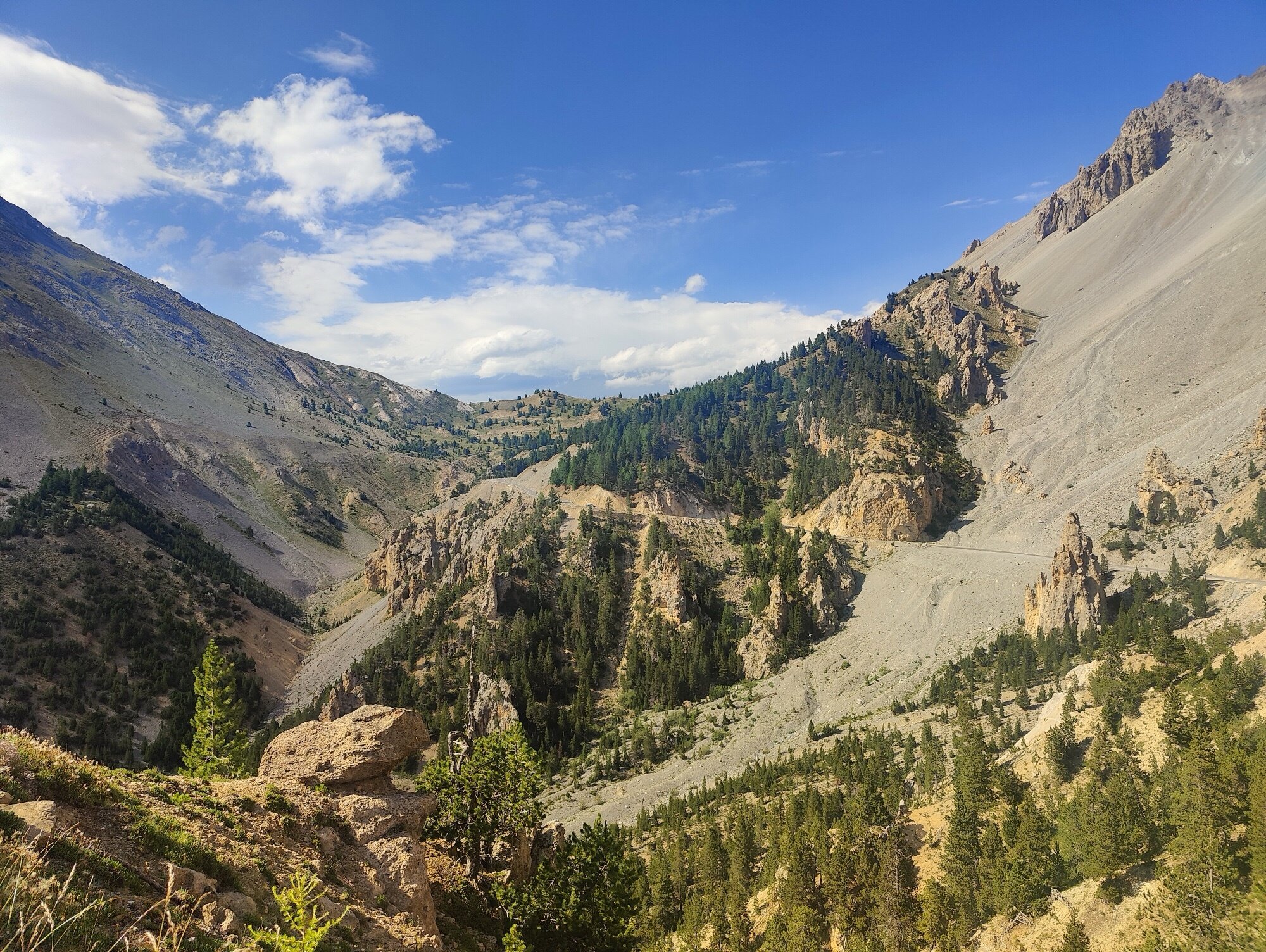
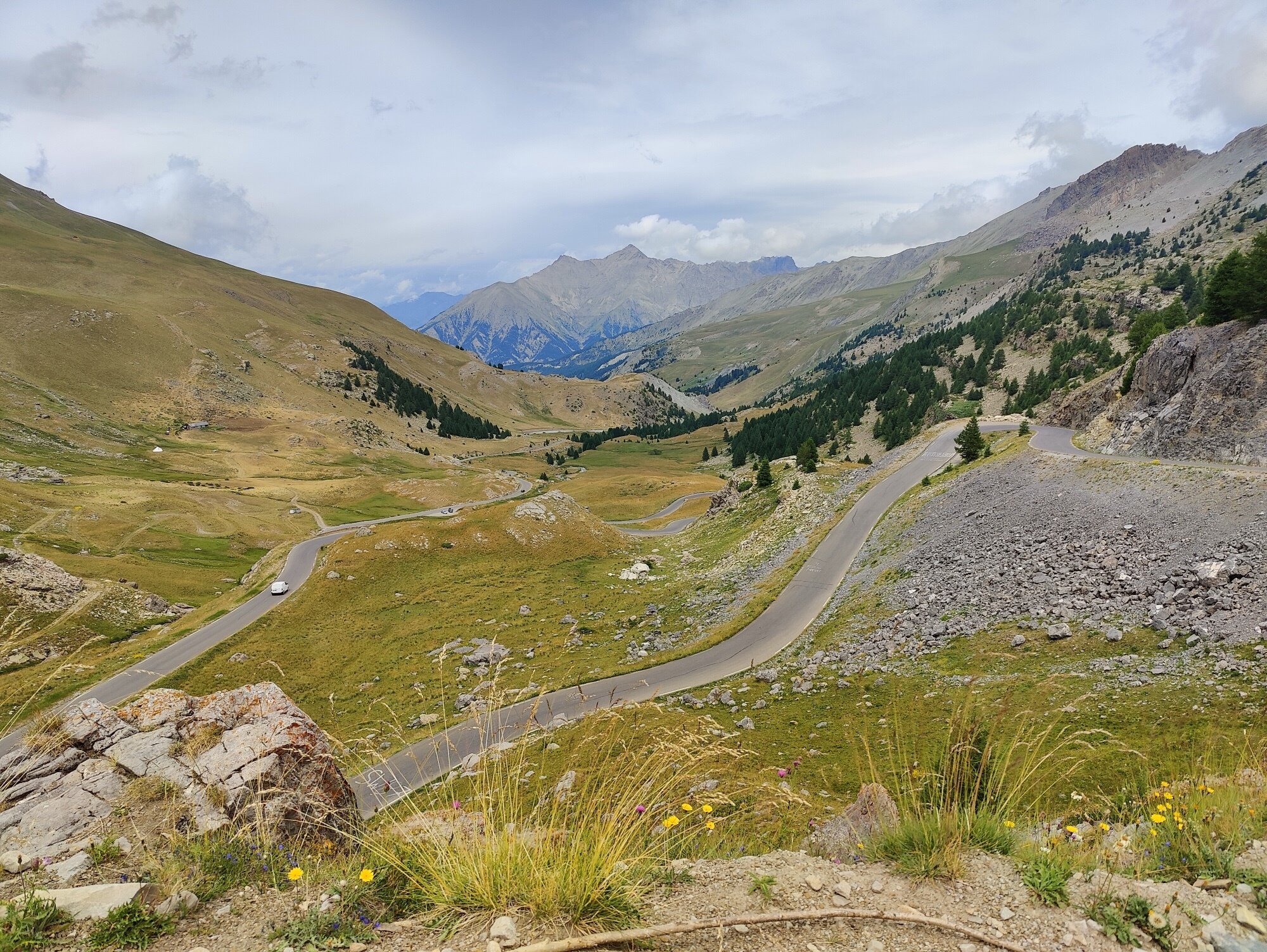
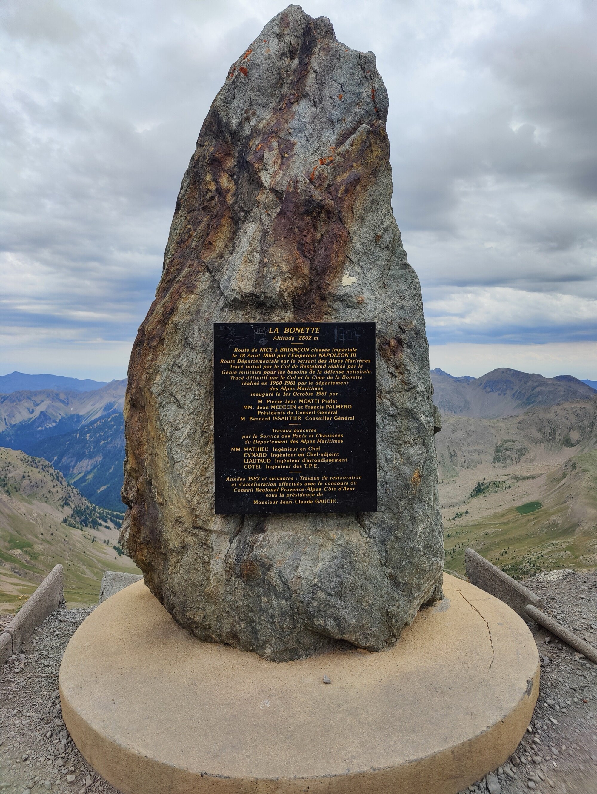
We stopped at the Col de Vars to warm up with a coffee and a pain au chocolat, trying to dry off a little before the descent. The ride down was beautiful but very wet. When we reached the junction for La Bonette, we decided to climb directly. We knew it was going to be long and also the highest point of the whole trip, at more than 2,800 metres. It was raining, but thankfully it eased off during the climb, which was a relief. We stopped just before the top to eat a sandwich and recharge the batteries, then pushed through to the summit — the Cime de la Bonette.
We didn’t linger — the sky was turning very dark even though it was still afternoon. Thankfully this was the shortest stage in distance, but we still had the whole descent ahead. It was pouring, and even fully layered up the cold cut right through. But I knew it was just the descent — once down in the village we could dry off and warm up. We made it to Saint-Étienne-de-Tinée a bit earlier than the other days, so we caught the end of the day’s Tour de France stage. Dinner, groceries for the next morning, and more time to recover.
A long, steady climb from the Durance valley — or it should have been, if the GPS trace from the official website hadn’t sent us on a detour through dead ends first. Once on the right road, constant gradients through forests gave way to open alpine meadows. At the summit, a coffee and a pain au chocolat to get warmer and dry off a little before the descent.
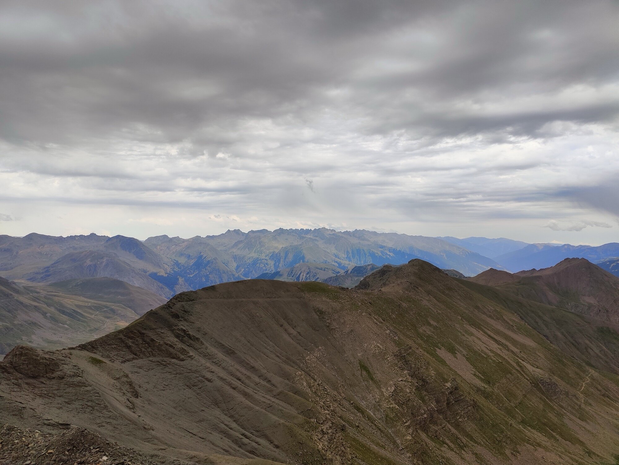
The highest point of the entire route at more than 2,800 m. We decided to climb directly from the crossing. It was raining, but thankfully it eased off during the ascent. We stopped just before the top for a sandwich to recharge the batteries, then pushed through to the summit.
Day 6
Saint-Étienne-de-Tinée → Nice
164.8 km | 3,084 m D+ | 4,229 m D- | 4 cols
The last day. We knew it was going to be a long one — the longest in distance — and four different passes to clear, which was going to be quite a lot. We started with a slow, steady descent at 40–50 km/h — a nice way to open the day. Then the Col Saint-Martin. After a short descent, we passed through the valley that was devastated by floods a few years earlier.
Then the Col de Turini. When we reached the top, we had a quick stop for lunch. Probably one of the nicest cols of the whole trip, and the descent was just as good — winding turns through beautiful scenery.
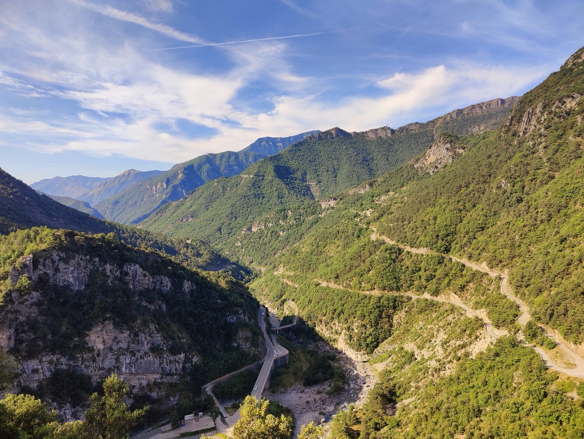
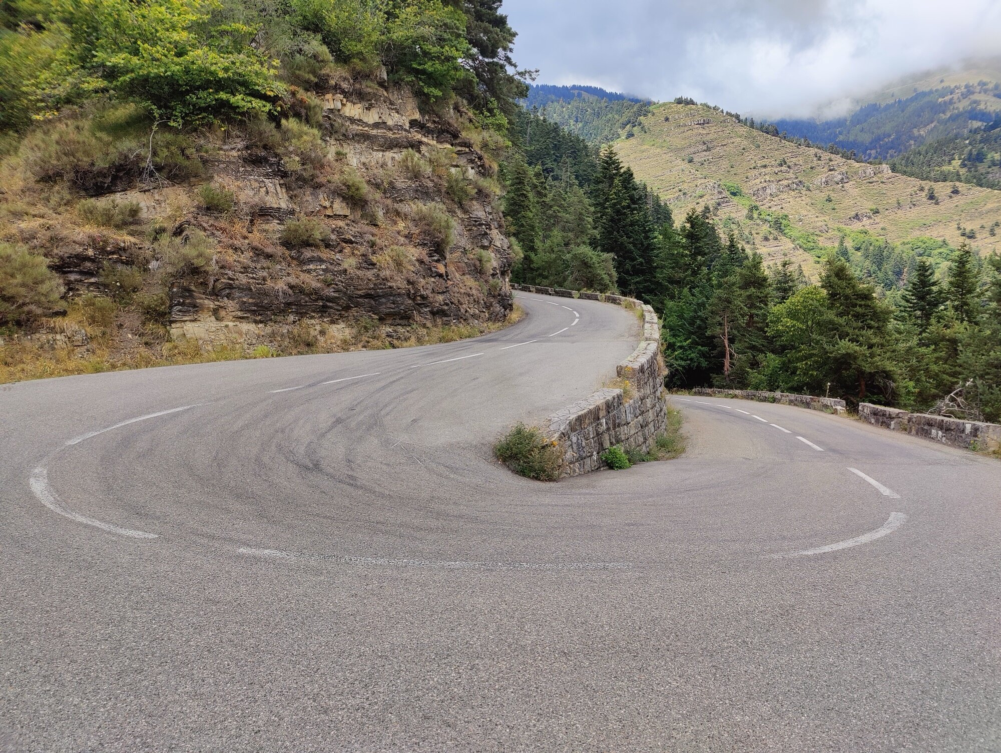
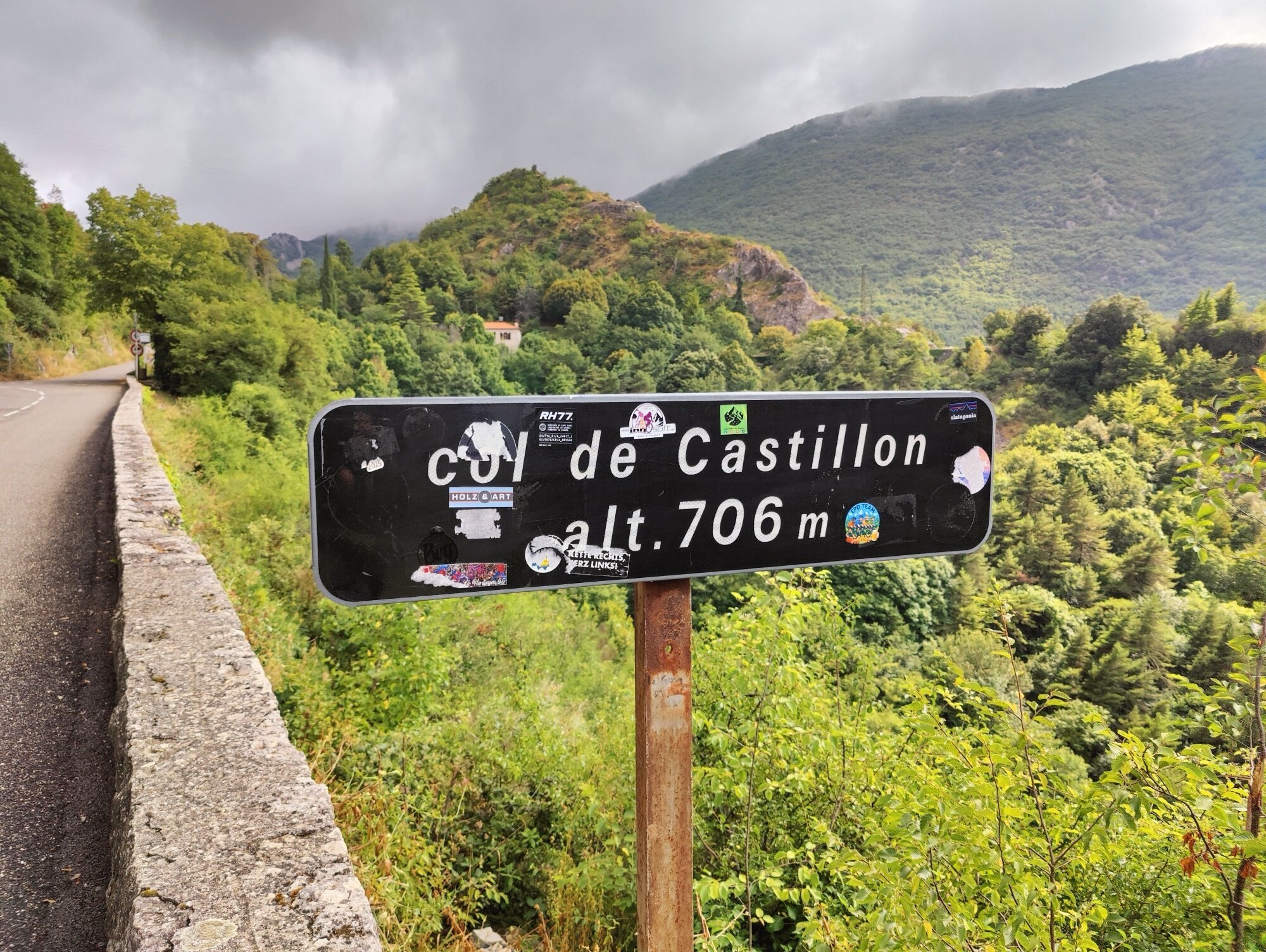
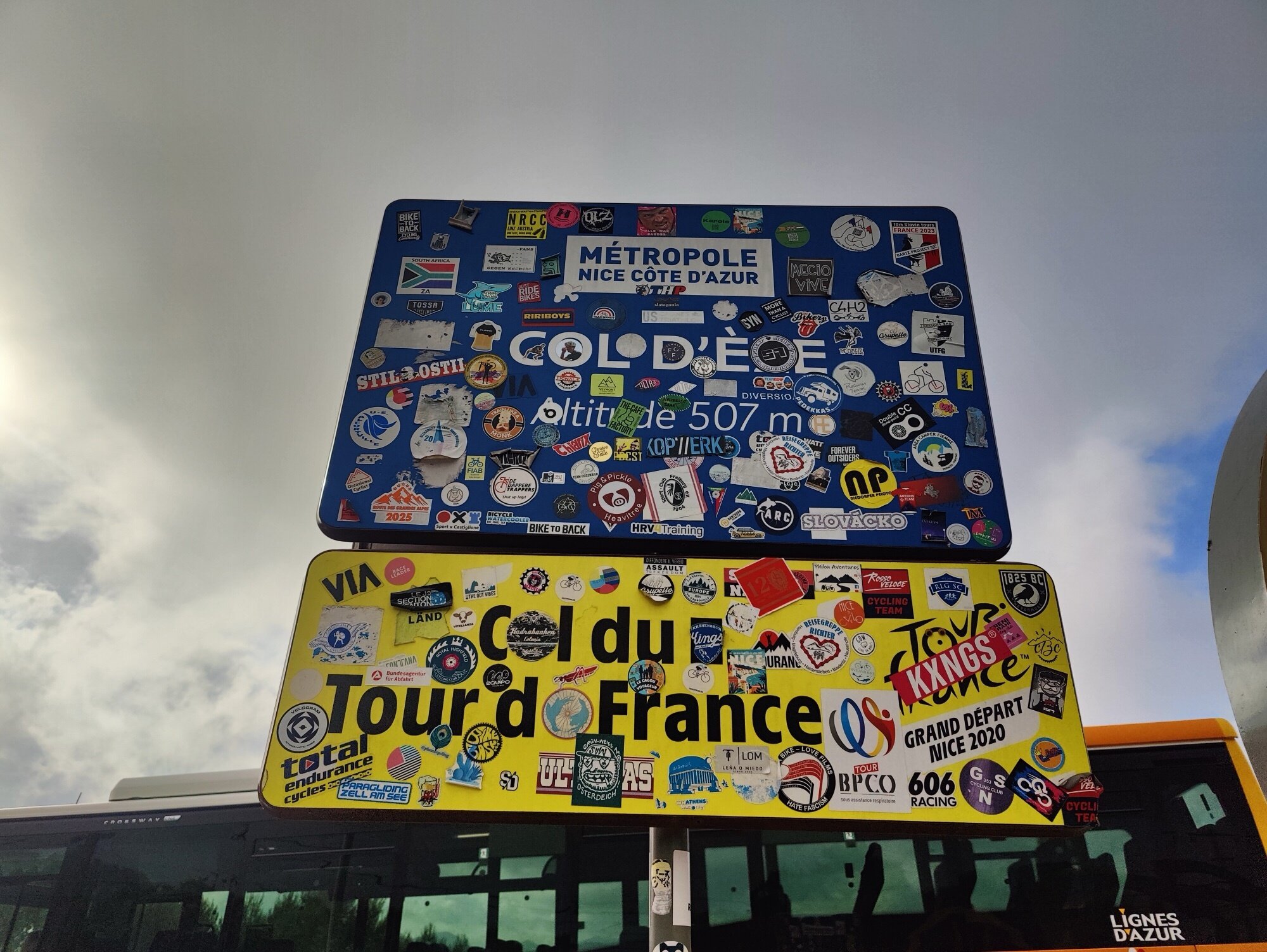
After that, one more col before Menton — the Castillon, the shortest one. Done quickly. The descent to Menton already felt like the finish — the sea was right there. For a moment it felt like it was over, like we’d made it. But no — there was still one col to go. The Col d’Èze, this little mountain between Menton and Nice. We thought it would be easy, but with heavy traffic it was actually a grind. Not the best experience at first, trying to escape Menton. Once we got a bit higher, it was better.
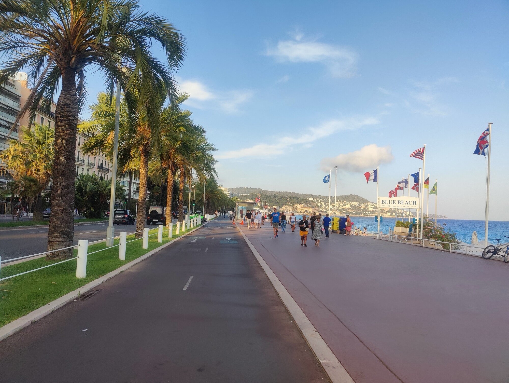
The Col d’Èze was the final pass, and then a full descent to Nice. We arrived around 7 PM and went straight to the sea for a swim. Beautiful weather, sun still warm, and a deep sense of satisfaction — we’d finished the whole trip without any real setback, just one tough day of rain. We hadn’t been sure at first whether to plan for six days or seven, but we’d chosen six so we’d have time to go see the Tour de France, which started just two days later. We’re glad we made that call.
The first climb of the final day, through the quiet forests of the Mercantour. A shaded, peaceful road after the exposed, rain-soaked passes of the day before.
Famous as a stage of the Monte Carlo Rally, and probably one of the nicest cols of the whole trip. A quick lunch stop at the top, and a descent that lived up to the climb — sweeping turns through lush forest.
The shorter one before Menton — done very quickly. The sea was already right there.
The last col of the Route des Grandes Alpes — this little mountain between Menton and Nice. We thought it was going to be easy, but it was actually pretty long because of all the traffic. Not the best experience at least in the beginning, trying to escape from Menton. Once a bit higher up in altitude, it was better already.
The numbers
| Total distance | 725.8 km |
| Total elevation gain | 17,420 m |
| Total elevation loss | 17,804 m |
| Cols crossed | 16 |
| Days | 6 |
| Highest point | 2,802 m (Cime de la Bonette) |
| Start | Thonon-les-Bains (Lake Geneva) |
| Finish | Nice (Mediterranean) |
Looking back
And just like that, the Route des Grandes Alpes was done — six days, from the lake to the sea. Everything went smoothly: no mechanical issues, no real setbacks, just riding. A superb experience from start to finish.
Taking a step back, it’s hard to believe we covered that many kilometres in so little time. Having crossed the Alps on foot a couple of years earlier — fifteen days of hiking through roughly the same mountain ranges — it feels a bit surreal to retrace a similar trajectory on the road, but so much faster. The descents alone are a different world on a bike.
The weather treated us well overall, even if we got a bit of everything. Scorching heat on the Galibier and Izoard day, a full day of rain the next, and a cooler-than-usual finish as a cold snap started moving in toward the end. But apart from that one tough day, conditions were on our side.
No punctures, no breakdowns, nothing. Just the road, the cols, and the simplicity of travelling light on a bike with barely any luggage. It’s hard to beat that kind of freedom.