Zugspitze: Hiking to the Top of Germany
Activity stats
Download route data
Import this GPX file into your GPS device or mapping app.
The Zugspitze — 2,962 metres, the highest point in Germany 🇩🇪. The plan was straightforward: hike there and back from Garmisch-Partenkirchen in a single day, on foot, through the classic Reintal valley route. Over 44 kilometres, nearly 2,700 metres of climbing, and no cable car. Just legs and stubbornness.
Before dawn
We woke up around 4 a.m. to catch the first bus to the Olympia-Skistadion, the ski jumping venue on the edge of town that also marks the start of the trail into the mountains. Walking through the streets of Garmisch in the dark didn’t seem like the most exciting way to begin, so the bus gave us a head start straight to where things get interesting.
Just before 5:40 a.m. we were moving. No time to waste — the goal was to do the whole thing out and back in one day, and we already knew from the numbers that it was going to be a long one. A little more than a marathon in distance, with a mountain on top of it.
The Partnachklamm detour
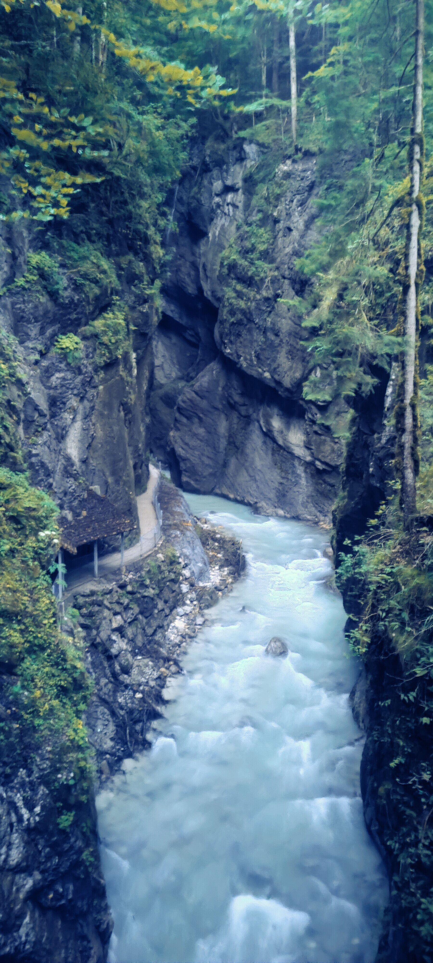
The trail begins gently, heading toward the entrance of the Partnachklamm — a dramatic gorge carved by the River Partnach, over 700 metres long and up to 80 metres deep. But there’s a catch: the gorge requires a ticket and doesn’t open until 8 a.m. in summer. Waiting two hours was not an option.
Fortunately, there’s an alternate trail that climbs up and over the ridge above the gorge, then drops back down on the other side. It adds roughly 100 metres of elevation each way — not significant in the grand scheme of things, but not the most exciting start to the day either. We’d have to do it again on the way back, which made it feel slightly worse than it actually was.
Through the Reintal valley
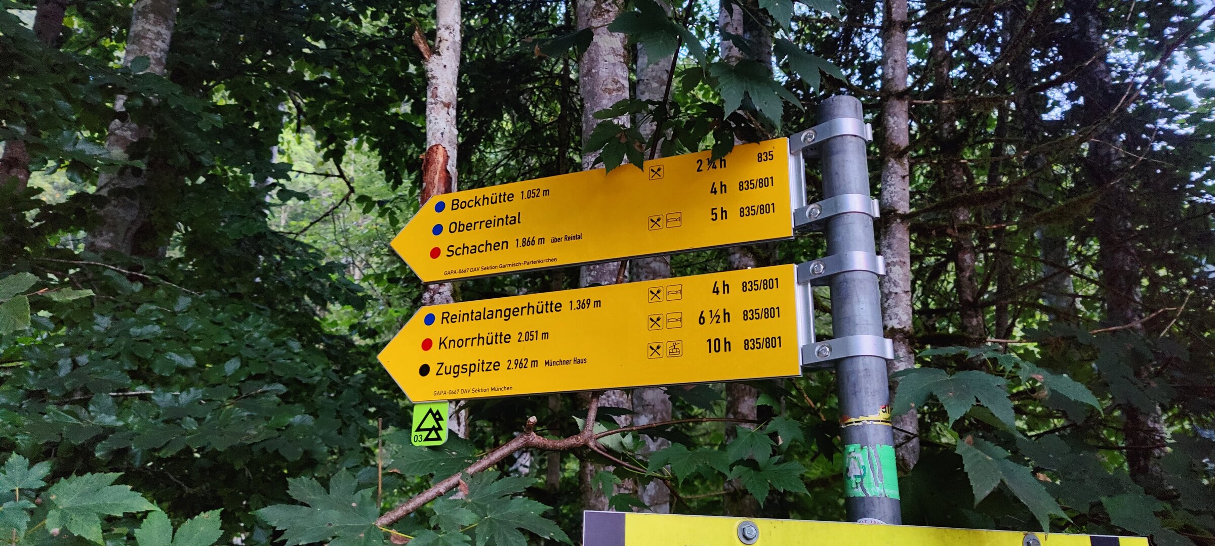
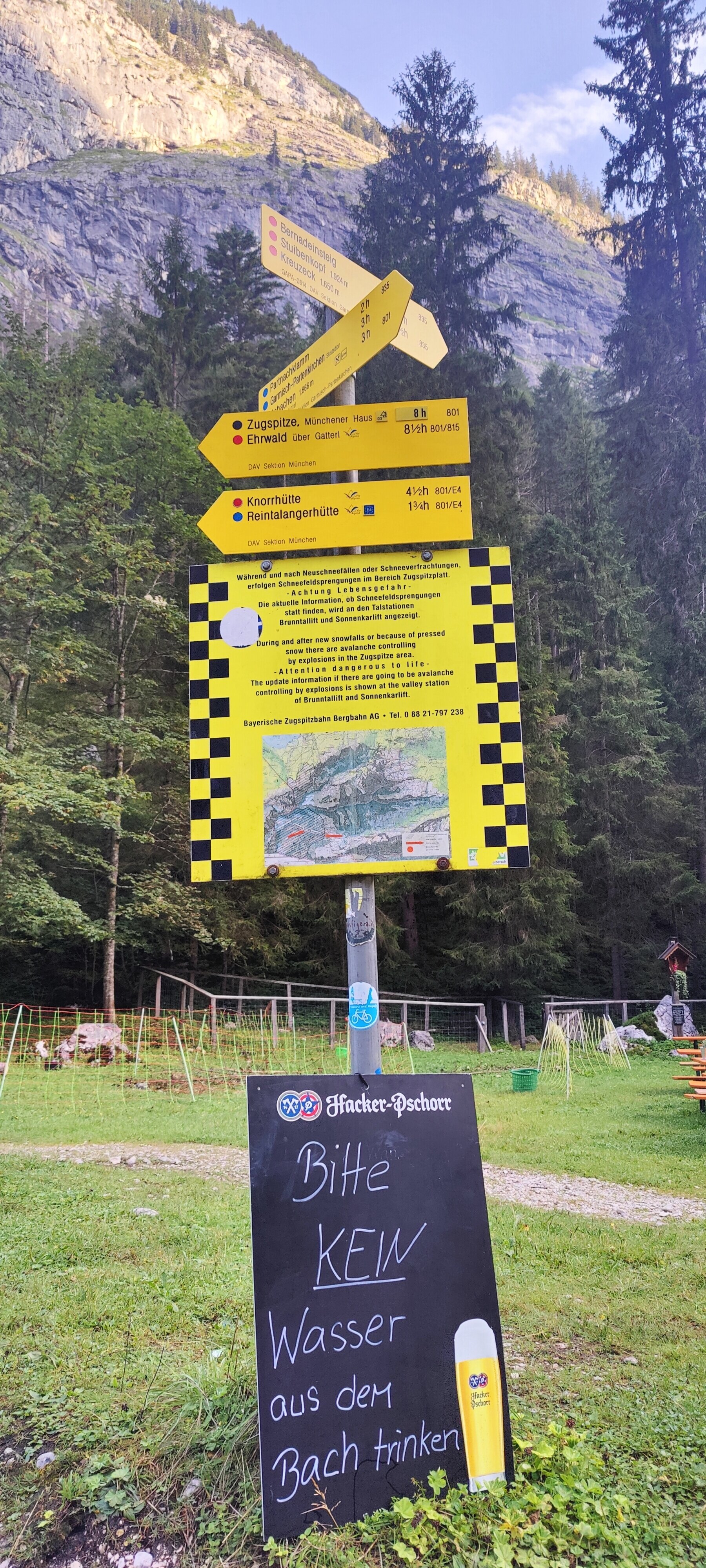
A signpost just past the gorge helpfully informed us that the Zugspitze was 10 hours away. What it didn’t mention was the 10 hours back.
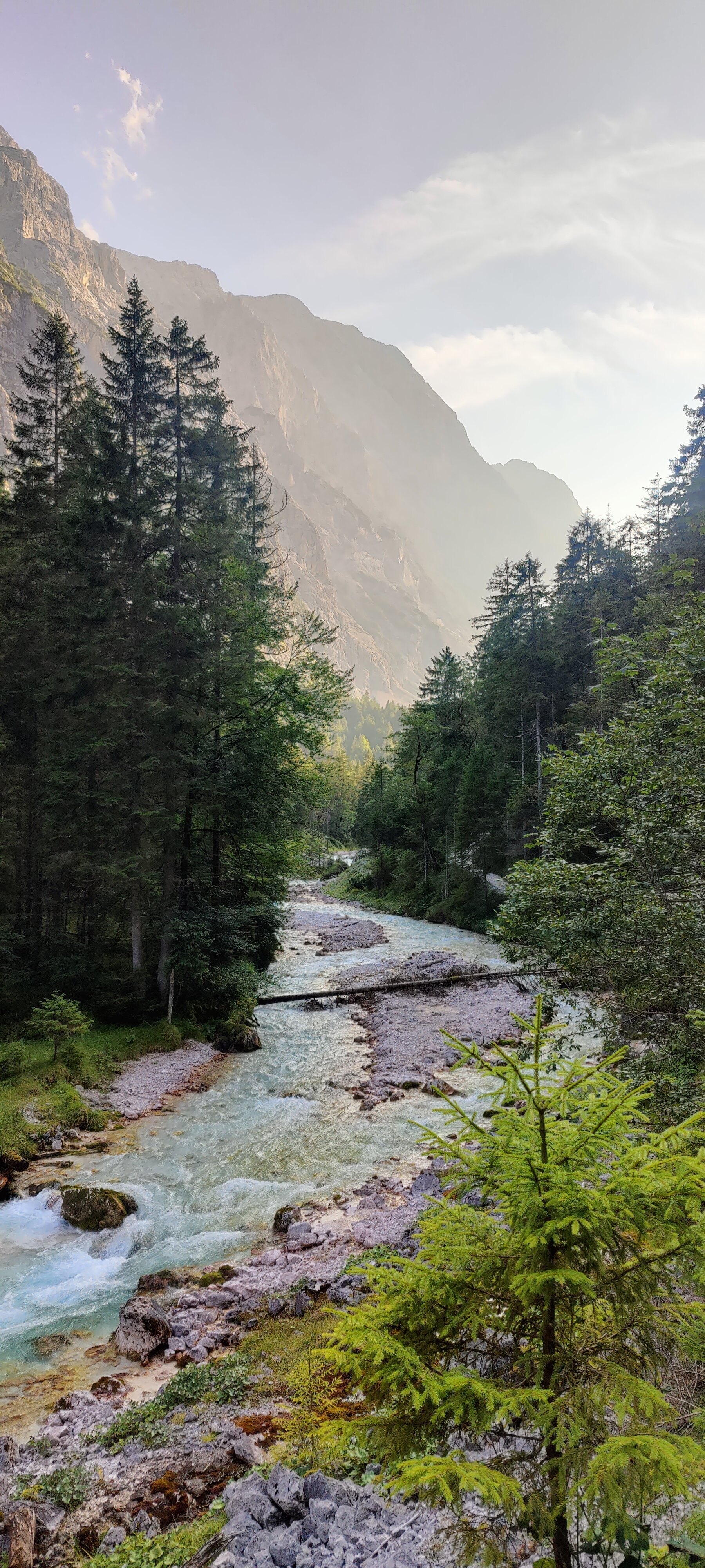
Once past the gorge, the trail settles into a long, steady climb along a wide forest road through the Reintal valley. The Reintal is one of the most impressive near-natural valley landscapes in the Bavarian Alps — a broad glacial valley with the River Partnach flowing through it, flanked by the towering walls of the Wetterstein Mountains on both sides.
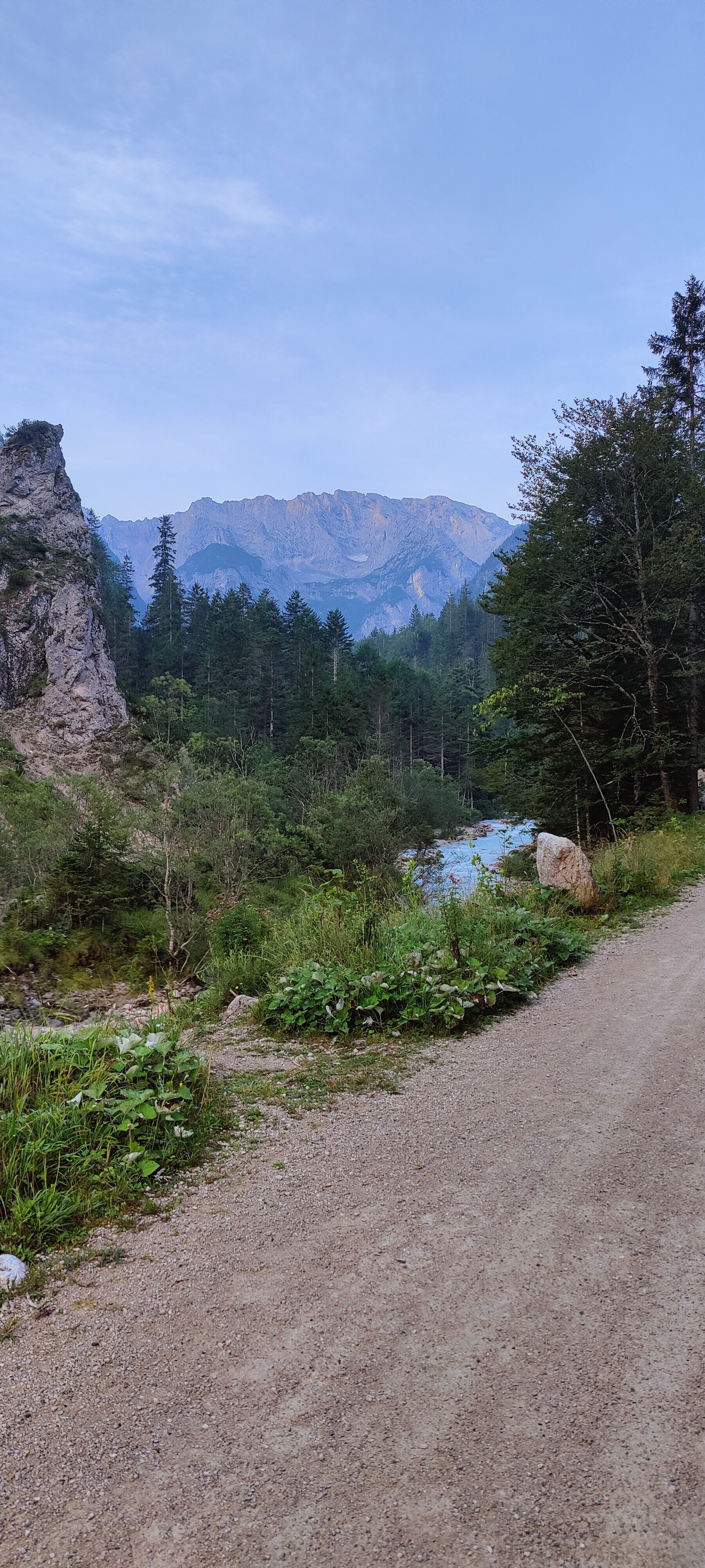
The first stop was the Bockhütte, a small shelter partway up the valley. A quick pause, a few sips of water, and we were moving again.
The trail continued upward, still gentle, until we reached the Reintalangerhütte at 1,366 metres a little before 9 a.m. — the main hut in the valley, run by the Munich section of the German Alpine Club. By then there were more people around: hikers who had spent the night at the hut and were just starting their day. We were catching up to them, despite having set off hours earlier from town.
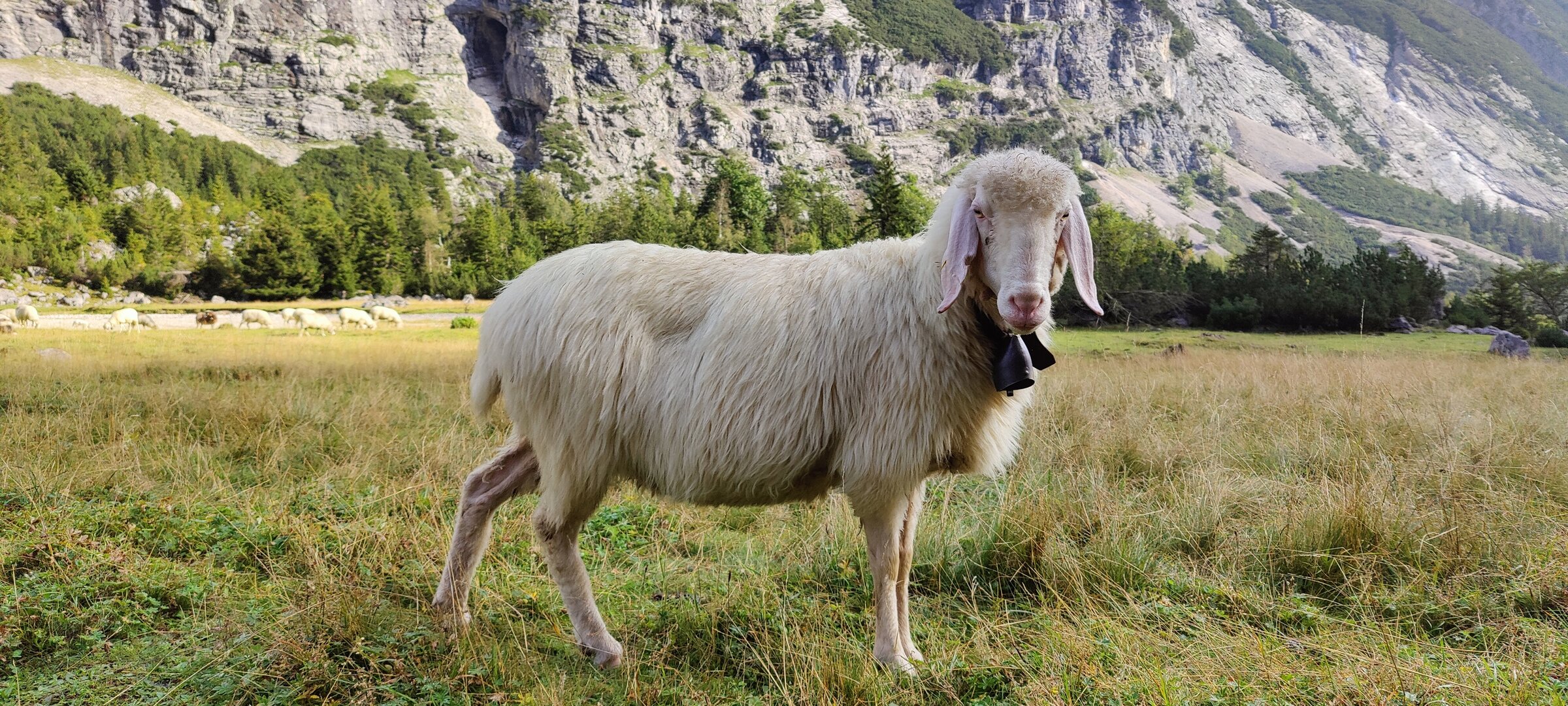
A sign at the hut warned against drinking water from the river — sheep herds graze the upper pastures at the end of August, and the runoff can be contaminated. Fair enough. We topped up from the hut’s tap and kept going.
Into the alpine
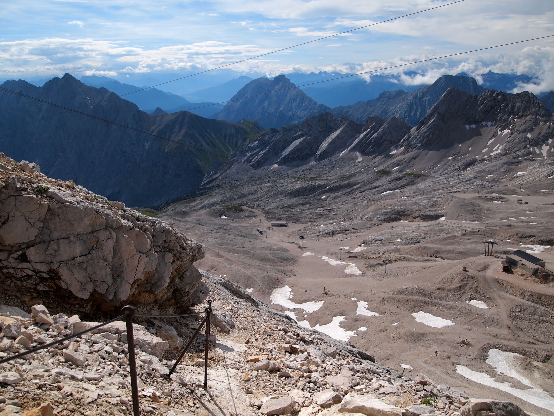
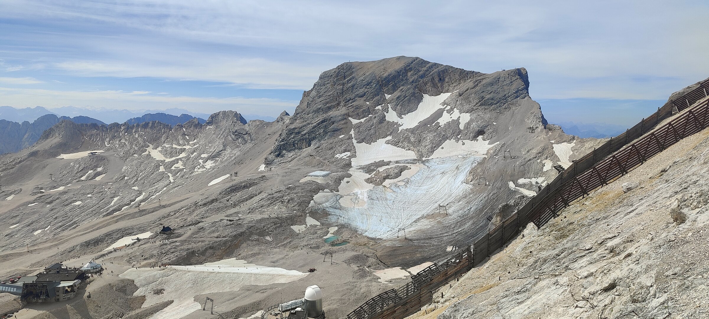
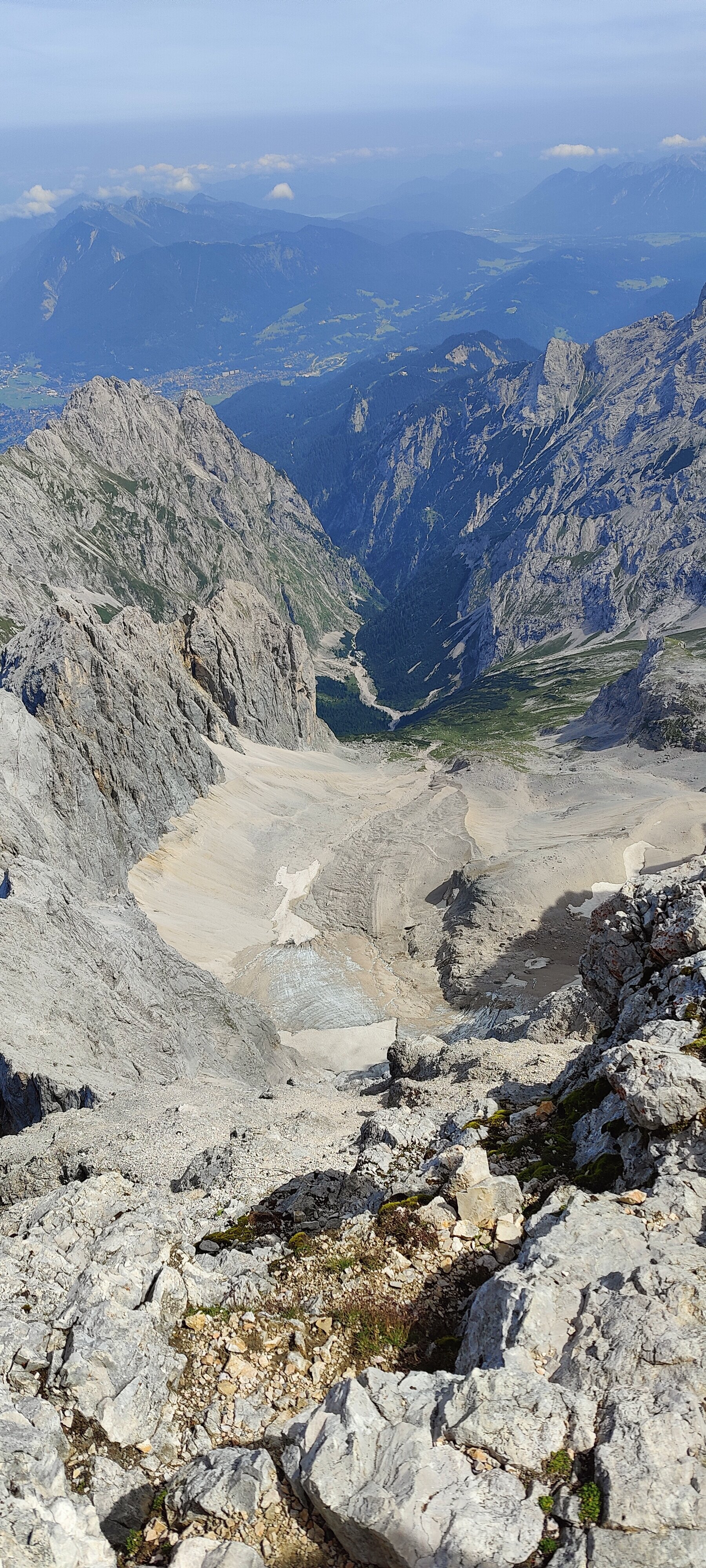
Above the Reintalangerhütte, the character of the trail changes. The forest thins out, the ground becomes rockier, and the valley walls close in. The gradient steepens noticeably as the path winds up toward the edge of the Zugspitzplatt — the vast karst plateau that sits below the summit.

We reached the Knorrhütte at 2,052 metres a little after 10 a.m., the last hut before the top. Built in 1855, it perches right on the lip where the plateau drops into the valley, with sweeping views in every direction. By then we were overtaking more and more hikers who had stayed at the huts overnight — a steady stream of people all heading the same way.

The wall
And then came the final stretch. From the Zugspitzplatt, the summit looms above like a wall. You can see the people ahead of you, tiny figures picking their way up an endless slope of loose scree and small rocks. The ground is unstable, the gradient relentless, and every step feels like it earns you half a step of progress.
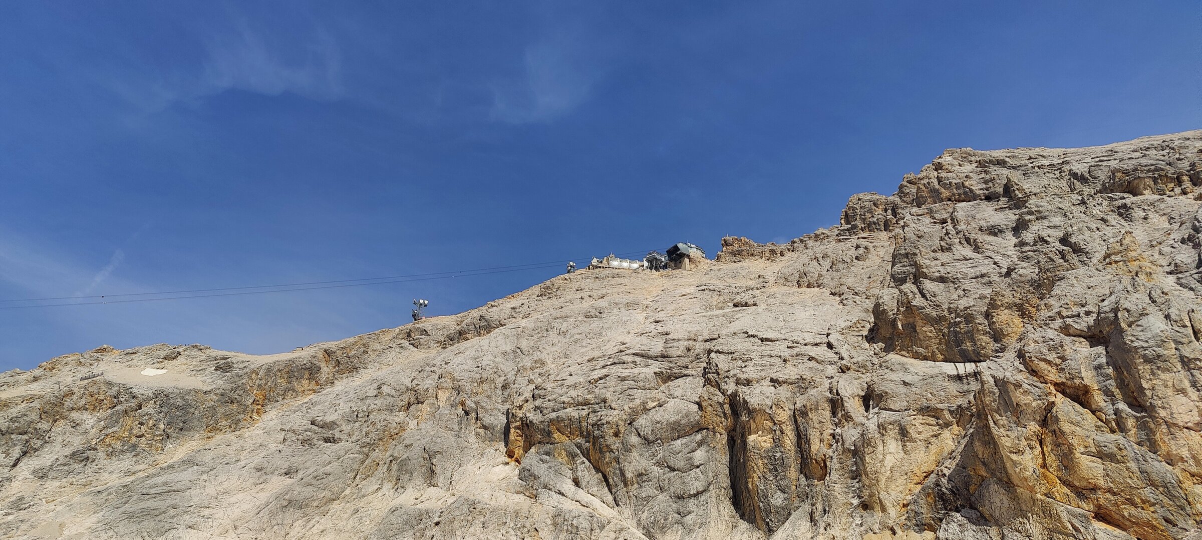
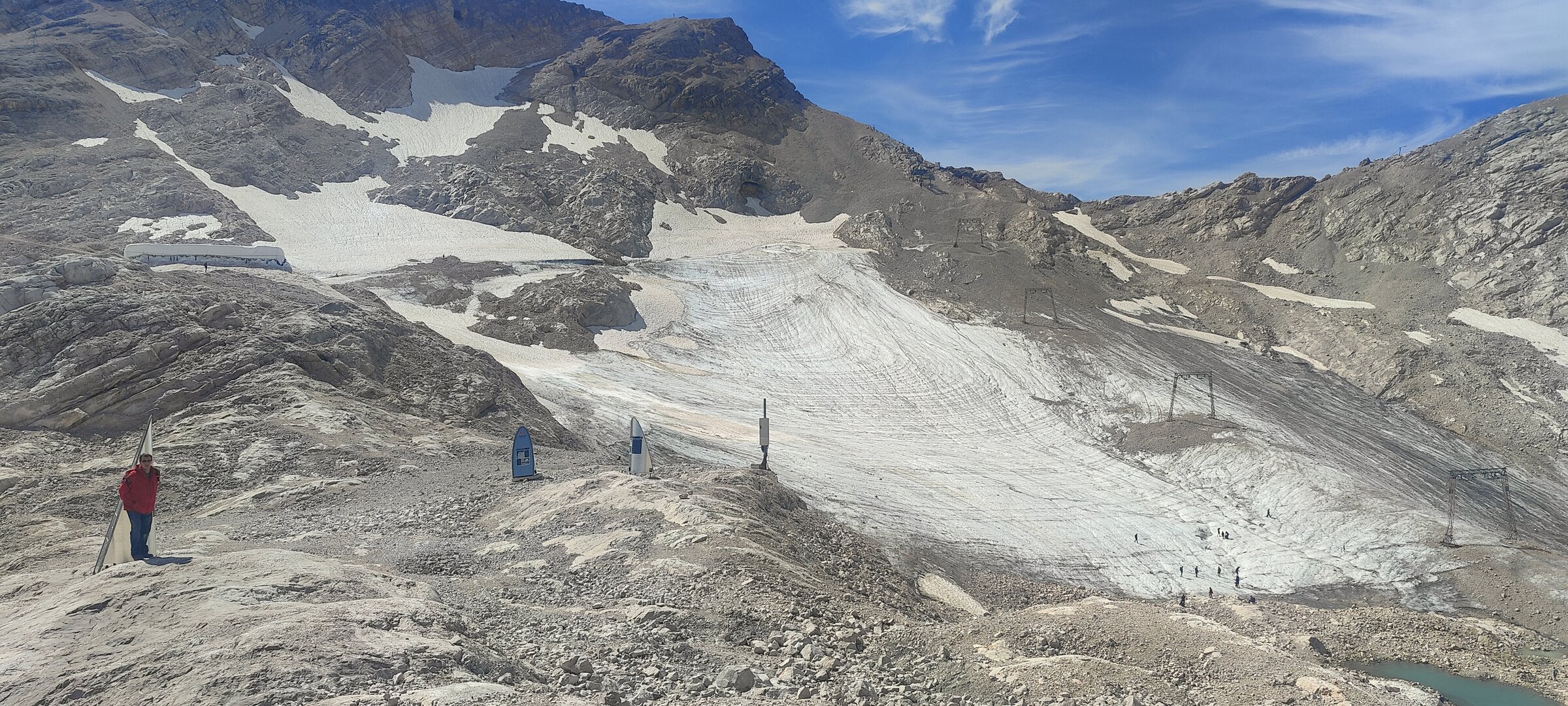
This was the steepest and most technical part of the whole hike. Near the bottom of this section sits the Sonn Alpin glacier station, where tourists arrive by the Bavarian Zugspitze Railway and take the Gletscherbahn cable car up to the summit. The contrast was striking — people in trainers and jeans stepping off a lift, while we ground our way upward on foot.
The last push to the top took about an hour, longer than expected. Fatigue was starting to set in, and the terrain demanded concentration with every step.
The summit
And then, a little after noon, we were there. The top of Germany. 🏔️
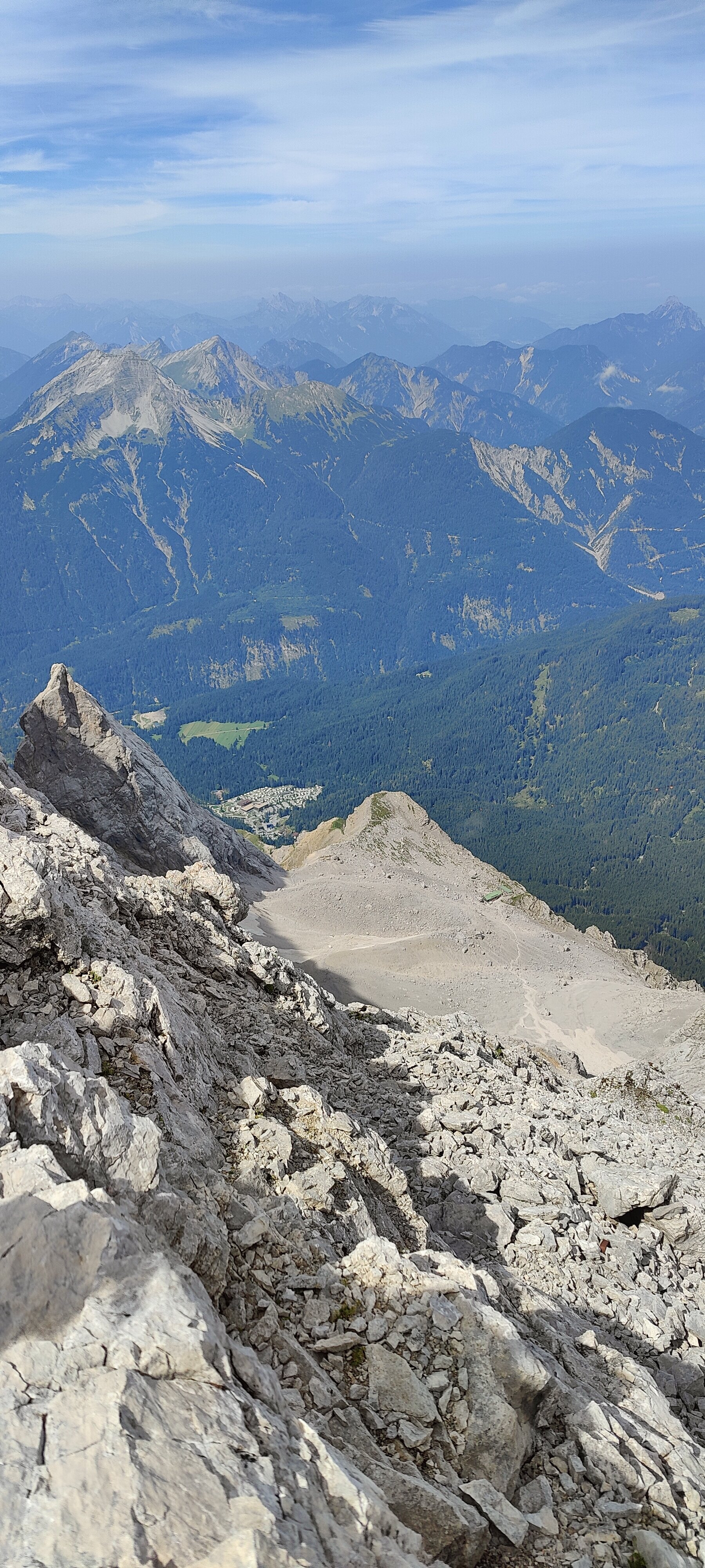
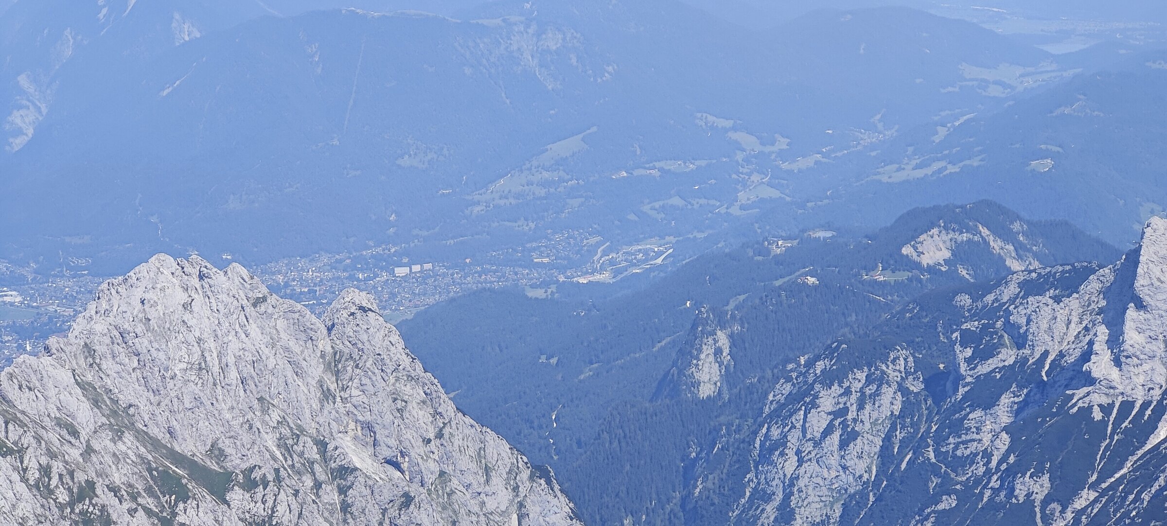
We found a spot to sit, ate lunch, and let our legs recover. The views from the summit stretch across four countries — Germany, Austria, Italy, and Switzerland — and on a clear day the panorama is breathtaking.
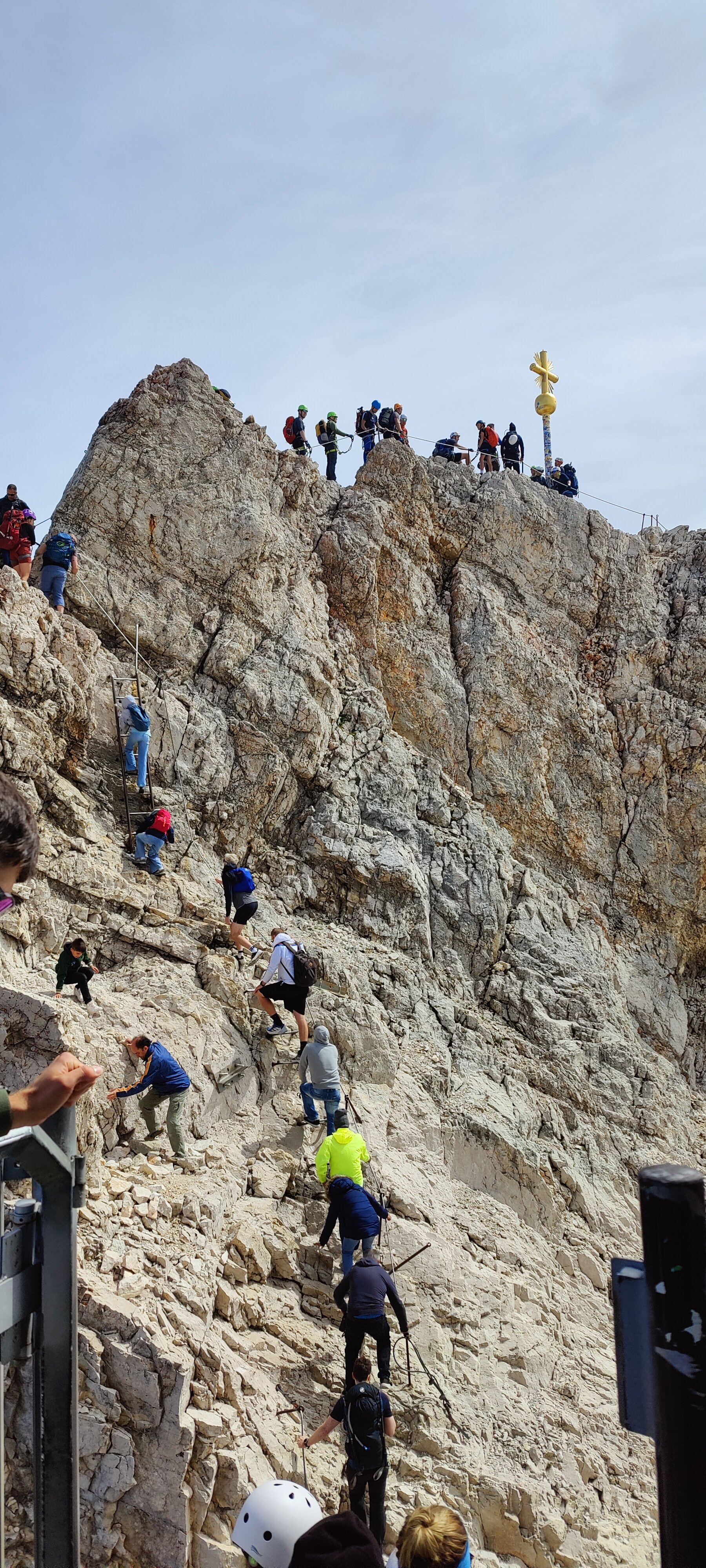
After refuelling, we made our way to the Gipfelkreuz, the golden summit cross that marks the true highest point at 2,962 metres. Getting there involves some stairs, a short exposed section, and more stairs carved into the rock. But the main obstacle was the queue — a long line of tourists, many of whom had come up by cable car, all waiting to reach the cross for a photo. Peak season, just after noon. We waited about 30 minutes, shuffling forward a few steps at a time. After hiking all the way from Garmisch, skipping the actual summit wasn’t an option.
The long way down
With the summit ticked off, we were only halfway through the day. The entire route back — every metre of it — awaited us on the same trail we’d come up.
Over 2,000 metres of descent in one go. The knees start to feel it quickly. We retraced our steps past the scree wall, through the Zugspitzplatt, and down past the Knorrhütte. The sun was beginning its own descent, though the long days of late August still gave us plenty of light.
At the Reintalangerhütte, we stopped to refill our water bottles. While waiting for the tap, we got chatting with a group of hikers. They asked where we’d been, and we told them we’d just come back from the summit. “How many days did that take you?” one of them asked. “We started this morning,” I said. “We’re heading back down tonight.” They looked at us like we’d arrived from another planet. 👽
Apparently most people do the Reintal route over two days, spending a night at one of the huts. Quite a few take the cable car down from the summit. Doing the whole thing on foot in a single day is, it seems, not the standard approach. Their disbelief gave us a good laugh and a little boost of motivation for the last stretch.
The boring bit
And then came the part no one tells you about: the final 15-plus kilometres of slowly descending through the lower valley. A wide, flat, endless trail. No people, no landmarks, nothing happening. Just walking for the sake of walking. This is the kind of section where blisters appear and motivation fades, but somehow our feet held up.
When we finally reached the far end of the gorge, we’d been hoping that the Partnachklamm might still be open for the return trip — it would save us the detour. No such luck. The gates were locked, the fences impossibly high. Back up and over the ridge we went, climbing those same 100 metres one more time with legs that had absolutely nothing left to give.
A short stretch of road, and then we were at the bus stop. Around 8:40 p.m., we caught the bus back to the centre of Garmisch-Partenkirchen.
The numbers
When you look at the elevation profile and see that Garmisch sits at around 700 metres and the summit at 2,962, you might think the climb is simply the difference between the two. But the Partnachklamm detours — twice — and the undulations along the trail add up fast. In the end, we logged close to 2,700 metres of total elevation gain over 44 kilometres, with a little over 11 hours of actual walking time.
The feet? Surprisingly fine. No blisters, despite the monotonous lower sections where they tend to appear. Would I do it again? Absolutely. 💪 There’s something absurdly satisfying about reaching the highest point of a country entirely under your own power, with nothing more than good shoes, reasonable fitness, and a healthy dose of determination.
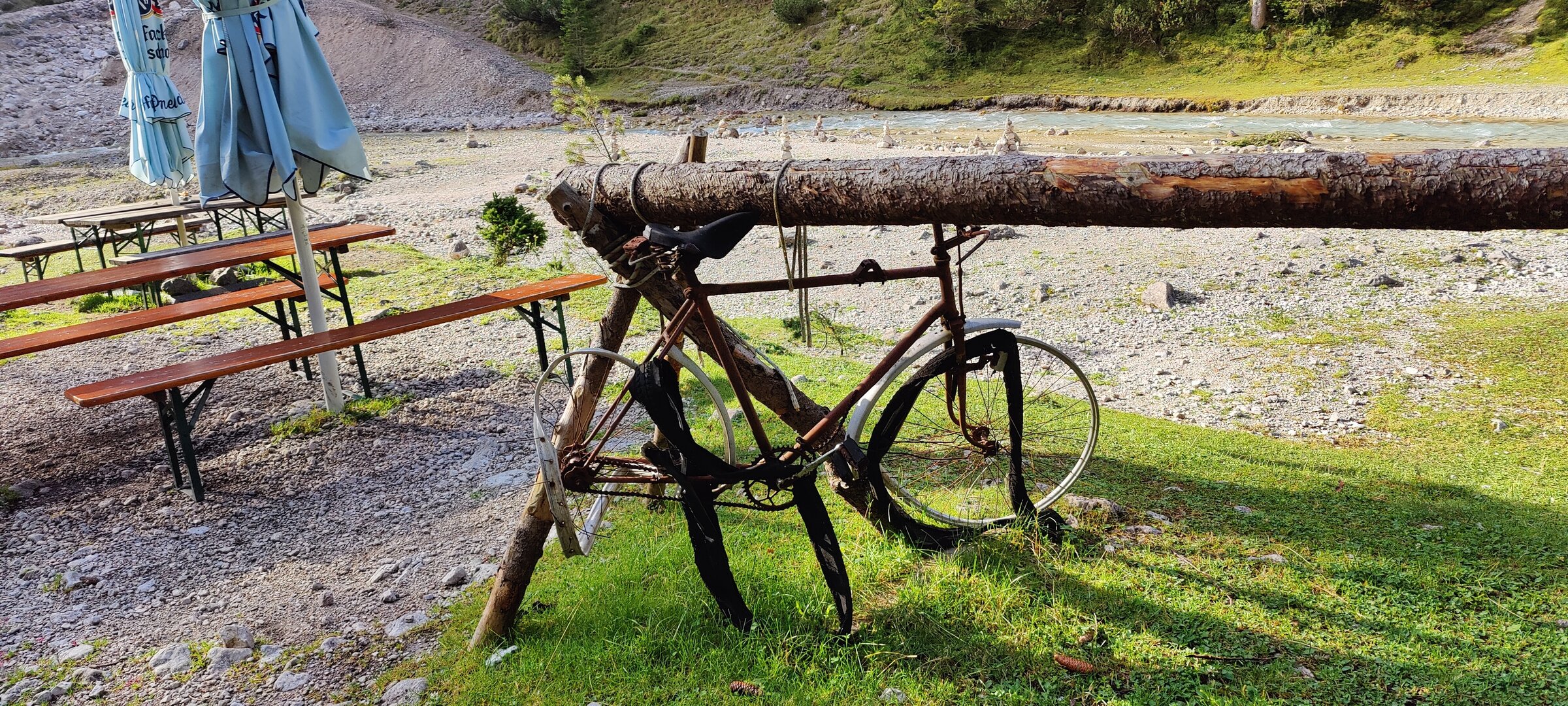
For anyone considering the same challenge, it’s also worth knowing that some people ride mountain bikes along the lower valley — we saw a few on the trail — and then switch to hiking for the upper section. It’s a good way to cut out the flat, less interesting kilometres and still get the full alpine experience on foot. Either way, start early, bring enough water, and be prepared for a very long day.